|
|
|
Utah:
Favorite Paved Summits and Passes
1. Some favorite paved
climbs
 La Sal
Loop Rd s(u)
: runs along above the canyons
of Moab and below the peaks of the La Sal
Mountains La Sal
Loop Rd s(u)
: runs along above the canyons
of Moab and below the peaks of the La Sal
Mountains
Ut 12: Boulder - Capitol Reef -
Boulder s(u) : I picked
this one not so much for the summit
section, but the canyons and sandstone
scenery in the section Escalante - Boulder
Cedar
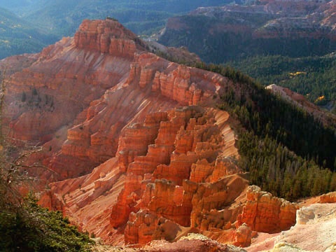
Breaks Summit :
this is a big climb and all the scenery
waits on top
Alpine
Loop Rd Summit : a
narrow, curvy road like this is a rare
thing, especially closet to a metro area
like Salt Lake City.
Bald
Mountain Pass :
Utah's highest paved road is not very
steep but it does have amazing alpine
scenery.
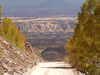
Huntington
Canyon / Fairview Canyon Summit
: this Wasatch Plateau climb is
still covered with snow, when the heat has
taken over the canyons
2. Some favorite UTAH
summit day LOOPS.
Most of these are mixed surface rides.
They are grouped by time in hours, it took
me to complete the loop. Within each group
the longest rides, mileage-wise, are
listed first. This results in a rough
ordering within the group, listing the
slower rides later. The added difficulty
could be due to any number of factors,
including climbing, surface, specific
weather conditions encountered, or just
being personally able to traverse the loop
faster for even more reasons. There are
links to all (or most) of all the summits
on the loop. All the summits are listed in
order highest first, and the first one
will include a complete specification of
the loop. For the newer rides, there is
also a link to the entire loop ride on the
gps site komoot. Usually there is small
additonal approach to the loop included in
the ride statistics. If this becomes more
than a couple of miles there will be two
separte statistic figures. The statistics
on the Komoot pages are somewhat
different, due to their calculation
methods. I am using the garmin figures
from the device.
 6 >
6:59 hours 6 >
6:59 hours
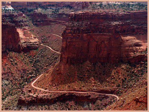
71.5miles - 4160ft - Ut313 - 6:20hrs :
partially PVD/UNP : Island
in the Sky s(u) , m3:7.5.23
This generic point on a plateau in
Canyonlands Park is the highest point for
several spectacular canyon approaches,
that can be ridden in loops. This one
includes the Shafer Trail road.
71.2miles - 5550ft - 6:57hrs : partially
PVD/UNP : FR150
- FR290 Mary's Nipple(sh) ,
m5:13.06.01
This route takes a closer look at an
interesting landform in a high plateau
north of I70, west of Salina. The part of
the loop that goes on I70 can be avoided
by another adjacent gravel road.
7 > 7:59 hours
90.2miles - 3360ft - 7:05hhrs : almost
entirely PVD: Fisher
Pass , r4:23.11.3
Loop around the Stansbury Mountains in
Utah's western desert. The first dedicated
transcontinental automobile road, the
Lincoln HIghway used to go over this pass,
and things do not look so much different
now.
 88miles
- 6900ft - 7:40hrs : partially
PVD/UNP : Barney
Top , Ut12
Henrieville - Escalante s(u) ,
m3:06.09.26 88miles
- 6900ft - 7:40hrs : partially
PVD/UNP : Barney
Top , Ut12
Henrieville - Escalante s(u) ,
m3:06.09.26
This loop crosses a rarely visited, unique
landform that crowds of people see from a
far away at Bryce Canyon overlooks
9 > 9:59 hours
103.3miles - 8500ft - 9:20hrs : partially
PVD/UNP : Kolob
Terrace s(u) , m3:19.10.12
Scenic ride on a plateau connecting Zion
National Park with Cedar City: This loop
includes a long section on I15. But I
wanted to include it inspite of this.
Coming at the end of the loop, it was a
nice way to meditate about the scenic
experience that went before.
|
|
|
|
advertisement
|
|
advertisement
|
|