 |
| |
Huntington Canyon/ Fairview
Canyon summit(u)
This route reminds me of another
great biking route to the east in Colorado, the
road over Grand Mesa. Neither one is marked as a
summit on maps, and both are great cycling
summits. When riding in lower Huntington Canyon
(on the east side), it may not seem that way at
first. The reason is possibly heavy truck traffic.
But the volume decreases drastically when
continuing a little further up the canyon,
especially during weekends. The striking
difference in climate and landscape between the
bottoms and top of this summit demonstrate the
fascinating variability of Utah.
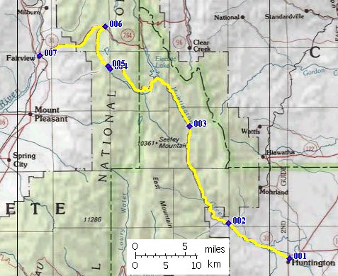
From East. Starting up the Wasatch
Plateau from Huntington, this summit looks like
anything but a great cycling route. The reason is
traffic, coal trucks. 10 to 12 axle double
trailers frequent this road along with other
industrial traffic. However, there is a reasonably
good shoulder and the Utah Highway department has
not rendered it useless for cyclists by placing a
rumble strip down the middle. Thank You. But
please read on, things get even better. One reason
for the coal traffic becomes immediately apparent,
a monstrous power plant at the mouth of the
canyon, complete with "scenic overlook" onto the
plant, labeled as such. Apparently some state
officials not only deem this plant economically
advantageous, but also an aesthetic addition to
the landscape of rugged dessert bluffs. T From West. The town of Fairview at this
end of the profile is a striking contrast to the
town of Huntington on the other end. Instead of
trailer parks and refuse, manicured lawns and
refuse turned into museum exhibits line the wide
mormon avenues. Beginning with the first 100
yards, that Ut31 turns off US89, the climb is
relentless and doesn't take a break below 8000
feet. The view ahead consists of angular slopes,
whose straight lines aim for a vanishing point
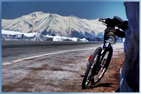
somewhere on the plateau. Once on the plateau at
around 8200ft, much climbing remains to be done.
Skyline Drive from the north joins the route and
continues with Ut31 to the top. Astonishing views
of the San Pete Range to the west and the Wasatch
range to the north open up. These scenes have very
different appeals depending on the season, and
make this my favorite paved cycling climb over the
Wasatch Plateau. An initial false top before the
real top is used as parking lot not only by
snowmobile motorheads, but also by Crosscountry
skiers and paraglide skiers into April. In my
experience traffic is very light on this side.
 |


 Approaches
 raffic conditions
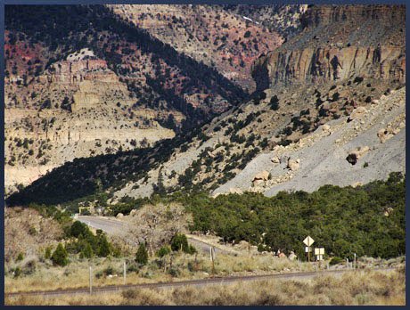
improve past the power plant, and after two more
coal mine turnoffs the industrial thoroughfare has
transformed into a lonesome country road. The
landscape undergoes equally drastic change to an
alpine canyon sculptured with straight edges into
changing plateau geology. A long shallow climb
finally picks up grade around 8200ft and climbs to
lakes frozen solid in April. It feels like the top
should be near, with passage between rolling
plateau knolls below overhanging snow cornices is
ahead, if it's April. Instead the road heads up
for the cornices and reaches a high point where
Skyline Drive ( a dirt route ) joins the road from
the south. Meanwhile the views to the north
stretch to where to Wasatch Plateau becomes the
Wasatch Range, appearing like a distant knife
inserted into the plateau loaf. There is no
elevation or summit sign along the route.
Descending on this - in many places, shallow -
climb still requires substantial effort if there
is a strong headwind, even if it does loose 3500
feet.
raffic conditions
improve past the power plant, and after two more
coal mine turnoffs the industrial thoroughfare has
transformed into a lonesome country road. The
landscape undergoes equally drastic change to an
alpine canyon sculptured with straight edges into
changing plateau geology. A long shallow climb
finally picks up grade around 8200ft and climbs to
lakes frozen solid in April. It feels like the top
should be near, with passage between rolling
plateau knolls below overhanging snow cornices is
ahead, if it's April. Instead the road heads up
for the cornices and reaches a high point where
Skyline Drive ( a dirt route ) joins the road from
the south. Meanwhile the views to the north
stretch to where to Wasatch Plateau becomes the
Wasatch Range, appearing like a distant knife
inserted into the plateau loaf. There is no
elevation or summit sign along the route.
Descending on this - in many places, shallow -
climb still requires substantial effort if there
is a strong headwind, even if it does loose 3500
feet.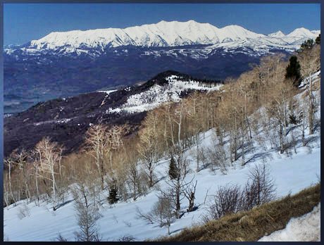
|
|
advertisement |
|
|
advertisement |