|
|||||||||||||||||
|
|
|||||||||||||||||
| |
|
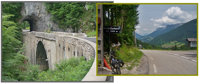
Col du Cucheron
This is the middle of three passes, on a route running
down the center of the Chartreuse Range. The Chartreuse is a
range of massive limestone cliffs, containing picturesque,
sleepy villages in the deepest parts of the valleys. I
grouped the Chartreuse with the Alps, like the other western
"prealps". But the range is also grouped with the
Jura mountains (fr.wikipedia), even if they have an entirely
different appearance.
There is also a Col de
Grand Cucheron in the nearby Hurtieres foothills to the
Belledonne Range.
My favorite view along this route comes just after making
this turn towards Col du Cucheron. Looking back the church is a
orderly picture of a rectangle with tower, set against the chaos
of a triangular mountain. The limestone hogback set on edge has
a steep cliff on the (geological) strike slope, and uniform
forest on the slip slope. Climbing in irregular switchbacks, the road straightens out
to pass another village, where no modern facades intrude - les
Arragons, and then quickly gains the gap that has been visible
from the road for quite a while. There are some skilifts here
that blend in well with the scenery
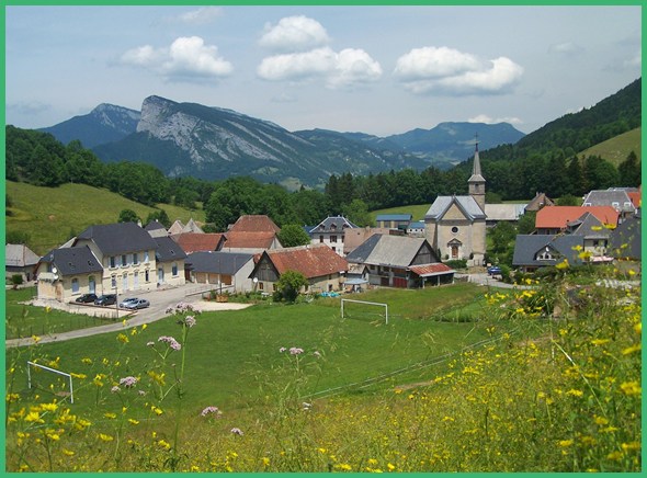
From South. (described downwards)
The road rolls down to the next valley town, that sits at the
bottom of this Chartreuse roller coaster. From here you can
climb Col de Porte, or exit
the Chartreuse via the Gorge du Guiers Mort, as the profile
does. The road dives in to deep forest, while up above ribbons
of limestone cliffs are set on edge in various directions. Three
relatively short tunnels follow in rapid succession, then a
longer one. An industrial ruin lines the road and the canyon
exits into St Laurent du Pont, which signals the return to a
modern world with more tourists 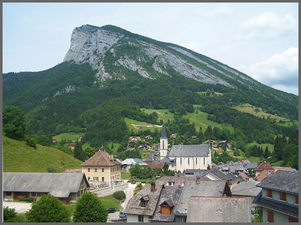
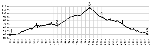
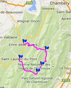
Dayride: Col du Cucheron , Col du
Granier , Col de Couz : La
Ravoire (south of Chanberry) > Col du Grand Granier > St
Pierre Entremont > Col du Cucheron > St Pierre Chartreuse
> St Laurent du Pont > St Laurent du Pont > D102 north
> les Echelles > Col de Couz > Chanberry > la
Ravoire <> several km out and back shoppint trip :
58.5miles with 5820ft of climbing in 5:31hrs (VDO MC1.0)
|
|
|
advertisement |
|
|
advertisement |