| |
| |
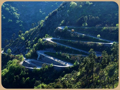
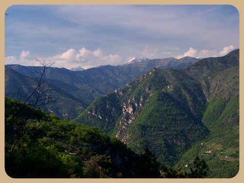
Col de Braus
The first time
I saw a picture of Col de Braus was in the
pages of a Lonely Planet Travel Guide:
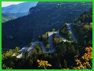
several walled switch backs neatly stacked
up on one another, and held in place by
walls that could double as medieval
fortifications. The caption read "the road
to Sospel". This was a little misleading,
because this scene is not really on the
direct road from the coast to Sospel.
Actually the pass is over the major ridge
that separates the Nice area from the Menton
area drainage. It seems all web pages about
this pass also contain a photograph of these
9 switchbacks. - Add two on this page, taken
during soft late afternoon light.
The first time I heard about Col de Braus was in the Denver airport when I left for this tour. I had struck up a conversation with somebody carrying a bicycle helmet as carry-on baggage. He turned out to be a racer and very familiar with the Col de Braus. This was when I learned that the picture from the guide book was actually taken on the Col de Braus.
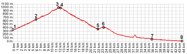
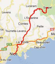
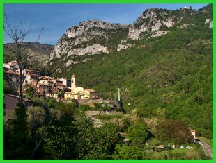
From North. The profile
begins in the lower part of Sospel, continues
through town and then turns left, away from
the route to Col
de Turini at the northern end of Sospel.
When you come down from Col de Turini you
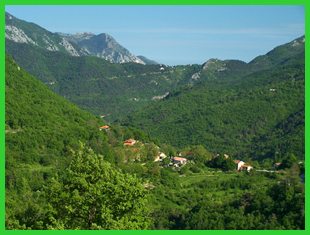
never enter Sospel. From East. (described
downwards) The summit is below treeline, but
on this side the view opens up considerably.
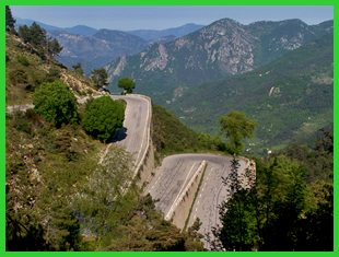
The series of switchbacks that are mentioned
in the introduction finally give way to a
small slot canyon and then a long descend in
the forest through Touet de l'Escarene, going
to l'Escarene. The profile continues all the
way to the Nice harbor on a busy road, in
order to show the maximum elevation gain.
A Dayride with this point as
intermediate summit are on pages: Col de Turini
The first pass with different start and end points on this Extended Tour is: Col de Vence 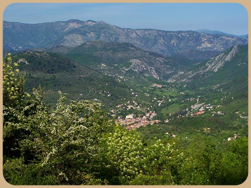 History Cycling. During the early years the Tour de France included more passes in the maritime alps. This road seems perfect for a large road race, because of its width and smooth condition (with a few exceptions). Between 1911 and the early WW2 years, Col de Braus was included in 24 out of 28 years, but after that only twice: in 1947 and last in 1961. France's Rene Vietto, whose tomb is on top of the pass, won this stage once in 1934. Only one cyclist won this stage three years in a row: France's Jean Alavoine in 1922-24.
back
to Cycling Passes in Europe |
|
|
advertisement |
|
|
advertisement |