| |
| |
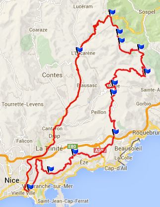
Chemin Strategique des Banqettes s(u) Col des Banquettes is a narrow
quiet road, that can be used to quickly escape
the nightmare traffic on the coast. It is the
highest point between a road connecting two
boastful towns. On one side, the most beautiful
- St Agnes, on the other side the most
"curiouse" Peillon. Peillon lies a little above
the route profiled below. But it's a small
detour.
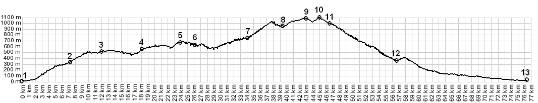
A third road joins the Col des Banquettes at its summit. This partially unpaved road goes quite a bit higher, over two more passes as shoulder points and has several great alpine views. It's partially unpaved. This third road is the subject of this page.
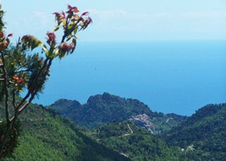
Leaving the Col de Banquettes, the road climbs
with many switchbacks up the forested slopes.
Looking back on a warm spring day, the blue sea
fuses with a blue sky in a layer of white. From up
here the houses of St Agnes don't seem to be in
nearly as a precarious position as from other
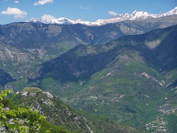
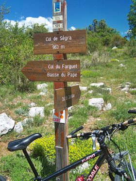
viewing angles The paved surface ends a few hundred meters later, and another small dip and climb lead to the next pass, Col du Farguet. This spot has the best views of the surrounding far peaks. I met a couple on a pique-nique here. I said no-thank you to their offer for a glass of wine, but I did accept the banana. From here signs point the way to options for the way down, left over (or under) Col de Cavalier to l'Escarene, or the option the profile takes, right and straight ahead to the Col de Braus, the easiest way back to pavement. The highest point along the way is traversed on this option. It is just slightly higher than the Col du Farguet.
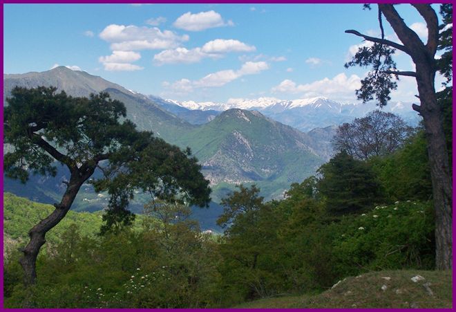
From North. (described
downwards) From the summit you barely need to
pedal the bike, to roll to the very top of Col de Braus on
reasonably smooth dirt. My own route continued at
this altitude, and even climbed a little higher to
collect more passes, which are also dips in the
road. It continued via Col
de l'Orme and Col de l'Able to Luceram. But in the profile I want to show direct
approaches to both sides for the summit. So I
picked the route down the west side of Col de Braus in
order to return to the Nice harbor. A Dayride with this point as intermediate
summit is on page: Col del'Orme 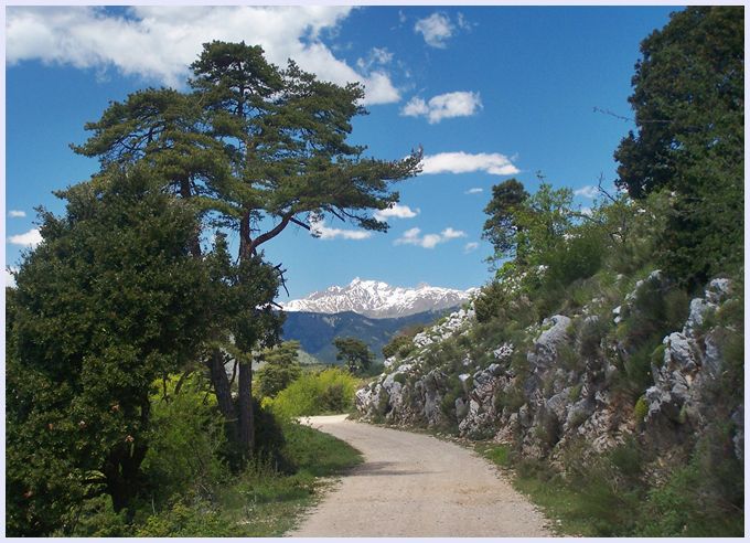 approaching the highest point
on the Chemin Stratequique des Banquettes
|
|
|
advertisement |
|
|
advertisement |