| |
| |
Col de Vence
This pass marks the
transition between heavy coastal traffic and the
start of potentially paradise like cycling over
low passes to the north and east.
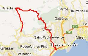
From East. I approached this pass by
following the bike path on the coast to
Cagnes-sur-Mer, and then followed road signs to
Vence. My guess is, that somebody familiar with
this maze of traffic knows a million better ways,
and none worse. But actually, it wasn't bad, heavy
traffic but good shoulder most of the way - and I
never had to stop to wonder where I should turn
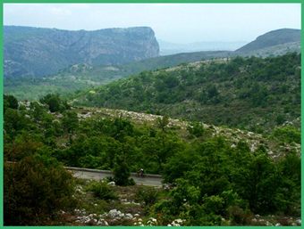
next. Across four lanes of traffic: a nice view of
Tourrettes-sur-Loupes, another hilltown. I
remembered reading in tourist brochure, saying how
essential it was to not miss this town. Actually,
the towns on the other side of the pass turned out
to be much more appealing. - Or maybe it was just
those four lanes of traffic that made it seem that
way. In any case - the second picture shows the
view without the traffic. In Vence conditions change radically. The traffic
stays in the valley. From now on I saw more
bicycles than cars. A coastal breeze blew in heavy
clouds, turning the scenery into something almost
Scottish. The vegetation on the other hand becomes
very sparse. I guessed that on top there would be
a great view of the sea and a craggy limestone
cliff to the east. I could tell I was on top, when
I saw all the cyclists putting on their jackets.
From West.
(described downwards) The road road remains
roughly at summit elevation for quite a while and
then traverses a section that is a little higher
than the pass itself. The vegetation returns
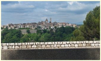
quickly. During my descent the wind blew a hole
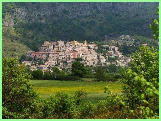
into the cloudy sky. The most memorable
scene on this side was the view of the next hill
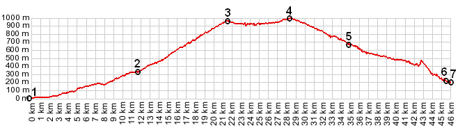
town, Coursegoules (last picture). From point 5
the profile descends further down valley on D6
through the Gorge de Loup to Pont de Loup to
maximize the elevation gain. My own route took
turned right at point 5, continuing to Greolieres.
Extended Tours: (|D2 Clue des Grolieres(sh)>) 177 bd de l'Observatoire, Nice > bike path along cote d'Azure south > east of Cagnes-sur-Mere > Vence > col de Vence > D2 > Greolieres (including several miles around this area): 39.0miles with 4380ft of climbing in 4:14hours on a fully loaded mountain bike(VDO MC1.0 m4:12.15) Day Rides from the same starting point (177 bd de l'Observatoire, Nice) are on pages: Col de Madone Col de Turini Col d'Eze Col de Porte D215-D216 Berre les Alpes s(u)
|
 Approaches
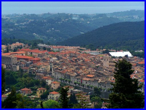
|
|
advertisement |
|
|
advertisement |