| |
| |
Col de Bigorno
So - now I have cycled just very
few of the Corsica summits, that people who know
these things, told me I just had to do. Now it was
time to just look at the map - and then ride
something that looked interesing, and then maybe
turn out to be very interesting, but who knows ?
Actually this may be my favorite Corsica ride, but then I haven't done very many. Also - Corsica rides should be divided into rides that involve the ocean in some way, and those that do not. Otherwise coming up with favorites may be just too difficult - there are so many. Anyway - this ride does not involve the ocean in a consequential way, but it does encircle a number of old hilltowns in panoramic fashion.
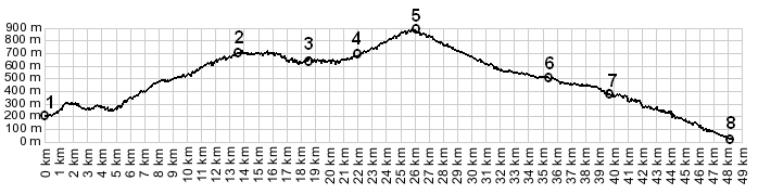
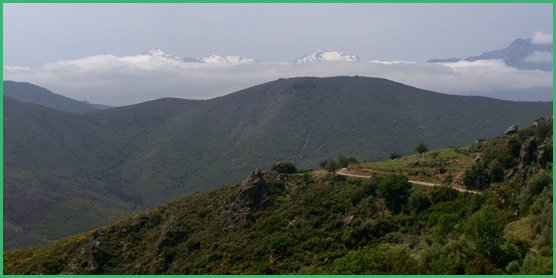
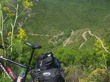
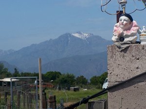
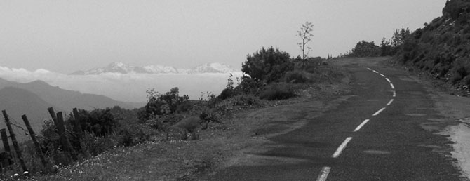
So why take the long way ? Well for starters, the Aigles de Popalasca will never look so imposing from the bottom. But this limestone comb is just the starting point in a panorama that grows ever larger as you climb. This limestone ridge gradually takes its place next to a more bread loaf shaped landform. Finally both are dwarfed by a snow covered ridge that slowly emerges from the clouds to the south. While the road climbs, it doubles back onto itself numerous times. Looking back - at times it's hard to tell, which small section of truncated road curvature below, comes before or after the other. The towns are still ahead. I cannot find the
first one marked on any map. But clearly it
exists. Before entering it, I also encountered a
rarity in Corsica, a comfortable scenic bench with
backrest, perfect for the purpose of trying to
recondition tired biking legs with a good lunch. From South. (described
downwards). This villages on this side have a more
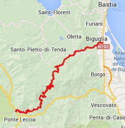
populated, alive appearance. No wonder - southern
Corsica's singular large city, Bastia, is not far
away. On this side the road is wider also, so that
it's easier to drive here too. The one location
shown most prominently on my map, on this side is
San Michele. In addition to a small village, this
refers to a nearby, small, attractive 12th century
church, a narrow building, built from stone of
contrasting colors, that sets it off perfectly
from the flowing green hills that encircle it.
Using two separate colors of rocks was
characteristic of the architecture of Pisa, and
Corisca was ruled by that state at the time. By the time the road reaches Col de San Michele,
the transfer back to modern times is complete.
Garage businesses sell useless knicknacks next to
the wide road, containing a still moderate amount
of traffic. There is one more way to delay the
delay the traffic nightmare of Bastia, and that is
to follow the narrow Defile de Lancone, opposite
N193 down the last canyon before the coast. A Day on a Tour with this point as
highest summit: COMPLETELY PAVED: ( < Col de Vergio
| SP10
Castelnuovo di Garfagagna - Seravezza s(u)
> ) Dayrides between this day and the next pass crossed as part of a day with different start and end points are on pages: Passo del Vestito
|
||||||||||||||||||||||||||||||||||
|
|
advertisement |
|
|
advertisement |