| |
| |
Passo del Vestito
The first view of the Alpi Apuani
mountains can be very striking. I had such a view
when approaching from the Lucca area. From certain
angles this range sticks out of the landscape,
almost like a coin stuck in the ground. They make
a rugged contrast to the surrounding, more rounded
mountains of the Apennin. This is a hint of the
special geological forces at work here.
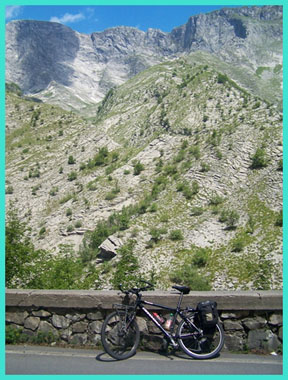
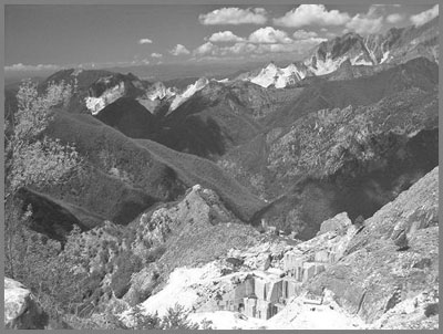
The reason that these mountains stand out is thought to be a fairly unique geologic process. The Italian boot is located on or near plate boundaries. But some of these plates are very small and at the mercy of the larger plates, that surround them. Consequently movement along these small plate boundaries sometimes changes direction, and the Italian boot sometimes kicks forward, and sometimes it moves back (geologically speaking). When this change takes place, mountain building happens along the plate boundary in a different way (sometimes called pullback mountain building), and the curious looking Alpi Apuani are the result. The Apuani Alps are not part of the european alps, the same way that the California Alps or the Japanese Alps are not part of the european alps. Mostly they are grouped together with the Apennin mountains. But really the Alpi Apuani Mountains are in a category by themselves. Another special thing about this pass are the stone quarries, which give the landscape with its mountains a cubist look - almost like a painting by Picasso. There is a peak in the picture, but there are cubes of mountain missing at many locations. The marble from this area has been mined for centuries for use in cathedrals and palaces. Even today the majority of tourists come to look at the quarries and their nondescript chunks of rock, rather than to look at the mountains and their amazing hilltowns. ... which brings up a third specialty about this pass, which just may be the most striking: the series of villages between Imperia and the summit on the western approach.
But that is a question for later. For now the calm quiet of this approach is just underlined by a a church and a group of old slate roofed houses around a lake: Isola Santa. The fact that this seems to be a damned lake with power generation doesn't intrude into the feeling of ancientness. After a few more turns the size of the wall of mountains to the north is demonstrated repeatedly. But the road remains in the narrow valley bottom. Even further up the road in Arni, there is still room for trees in the narrow v shaped canyon, together with a stylish church tower and an anti war memorial. Unlike "war memorials" these mostly depict a fallen young soldier with a dying look on his face, and a loved one mourning. There are quite a few dark tunnels along the
route, the longest on top. But they are not so
long and dark that one has to fear loosing
orientation. Hundreds of bicycles seem to pass
through here on the weekends without lights.
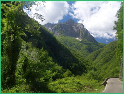
From West. It does not
really become apparent that this is the top until
the road exits the almost 1km long tunnel, and
presents a dazzling panorama in brand new
daylight. It is immediately apparent that this is
anything but a wilderness. There are chunks of
peaks missing. The amazing thing is, that somebody
found it necessary to climb this high into
vertical territory, just to carve out a piece of
rock and cart it back to the valley to make
houses, statues and cathedrals from it.
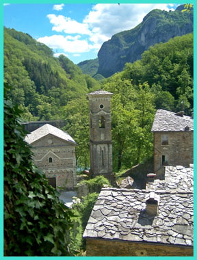
The road rolls downwards, and unlike the other side, traverses along a side ridge, making two more short tunnels necessary - more to come further down. The Mediterranean sea draws ever closer, as long ramps zig zag further down towards Massa. But the reason for the most stops on my ride were still ahead. Their names are Antona, Altagnana and Panana. The three church towers with their respective villages clustered around them make for an ever changing scenic arrangement, and the road does its best to deliver all sides, and that includes from above and from below. With decreased distance to Massa, the amount of cars parked at the entrances to the old towns increases drastically, symbolizing the general increase in traffic. However, I rode this on a Saturday and I saw more bicycles than cars, or maybe roughly the same amount, if you count the parked cars. Down in Massa signs draw you toward the "Mare".
But my own route headed south eastwards along the
base of the mountains. Historical Notes: WW2: A part along the road on the west
side was part of the Gothic Line. This line of
concrete bunkers, barbed wire and artillery
positions stretched across northern Italy from
Rimini to La Spezia. It was erected by Nazi German
forces in 1944. Even though by this time the front
in France had become more important, the offensive
by the allies in Italy was not withdrawn. But the
amount of soldiers and resources was decreased. By
August 1944 Germany and Italy were plagued by more
partisan forces, that favored the allies. Most of
the fighting along the line was done further east.
The special thing here is due this fact. Along
Passo Vestito some of the relics from this battle
line still exist without being destroyed. Dayride with this point as highest
summit: COMPLETELY PAVED: Passo del Vestito , Passo de Lucese :
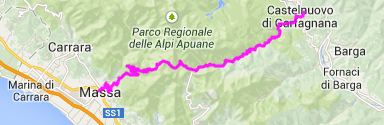
Borgo a Mozzano > Castelnuovo di Garfagnana
> Passo del Vestito > Massa > Montignoso
> Pietrasanta > Camaiore > Passo de
Lucese > Convale > back to starting point:
79.1miles with 6174ft of climbing in 6:46hrs
(Garmin etrex 30: m4:14.4.24). The last day with different start and end points
is on page: Passo di
Bigorno 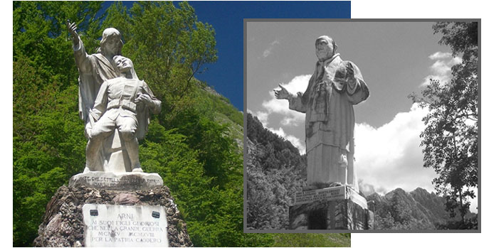
|
|
|
advertisement |
|
|
advertisement |