| |
| |
Vail Pass I have always had the
impression, that Vail Pass is Colorado's most
popular pass for cycling. I have never seen any
statistics on the subject. But in order to come
to that conclusion, all you have to do is ride
the pass on a warm summer weekend. The biking
scene covers all ends of the spectrum, families
with trailers, racers clad in advertising
billboards, children trying to ride in a
straight line, cycling club riders aligned like
ducks in a row, or sometimes even ski clubs
riding to the top where an elaborate catered
buffet waits for them. The reason for this: a
trail that is not only separate from the road,
but in most places far away from it, ideal
conditions for riding - at least uphill. The
descends are slower than they would be on a
paved road and require careful attention to your
fellow cyclists.
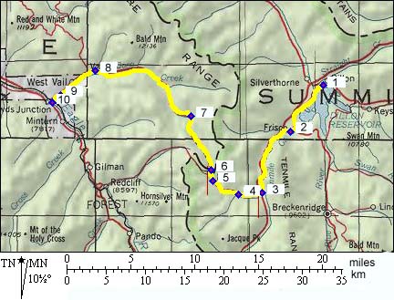
From East. Many cyclists
begin a ride over the pass in Copper Mountain. The
paved trailhead is easiest to access by car at
that location. But then you skip the ride through
Tenmile Canyon, a great chance to warm up, and a
nice little climb in its own right. The profile
starts all the way back at Dillon Reservoir. This
very first part also makes for a pleasant ride
along the lake, but hardly increases the elevation
gain. The first point on the profile connects to
the Loveland Pass
profile. The biketrail from Copper Mountain
quickly climbs to treeline. It continues through
alpine meadows, crosses into a large space between
opposing lanes of the Interstate, does a few
switchbacks ( careful on the downhill ! ), and
delivers the riders to an elaborate restroom
facility at the top. 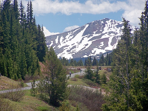 From West. The town of Vail
is usually thought of as a start or end on the
west side. But, as shown in the elevation profile,
including the part to Dowd Junction increases the
climb significantly. A signed bike route connects
the western end of Vail on the south side,
with Dowd Junction. The last point on the profile
connects with the Battle
Hill Summit and Tennessee Pass
profiles. A bike path on the north side of the
valley stretches through most of Vail Village.
Going up the pass, biking traffic funnels onto the
I70 service road. It crosses south of the
Interstate, and after the first short steep climb
becomes a biketrail. As the path climbs further,
it parallels the Interstate in close proximity on
its north side, treating the cyclist to smells of
burnt break pads and straining engine noise. Along
the top the trail leads along a small lake, onto
the service road to the elaborate rest facility
for tired drivers, who had to work so hard to get
to the top. 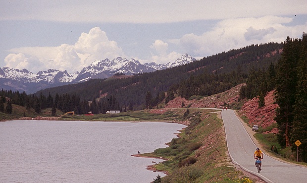 History Historically speaking, Vail Pass is a recent development, notwithstanding that today, it's the most popular point on the most important traffic corridor heading west, I 70. But the state was very different in the 1870s. Leadville was the most important city and all roads lead to Leadville. This meant traffic coming up Tenmile Canyon turned south over Fremont Pass. It was not until long after the economic importance of Leadville had diminished, that a direct route west became important enough to justify a road over this pass.
|
 Approaches
 Modern Highways (<
|
|
advertisement |
|
|
advertisement |