| |
| |
CR9 Turquoise Lake s(u)
When you figure freedom from
automobile traffic, escape from summer heat, and a
soothing scenery heavily into the equation, this
little paved road summit is a great little road
indeed. It is also quite popular with cyclists. It
doesn't really go anywhere, but if you really feel
the need to make a longer ride out of it, it can
be combined with passes of the Copper Triangle
Route (see Fremont
Pass, Vail Pass
or Tennesee
Pass). Personally I like to mix paved with unpaved
routes. This makes for many more opportunities to
explore the area around the lake further.
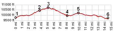
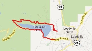
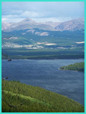
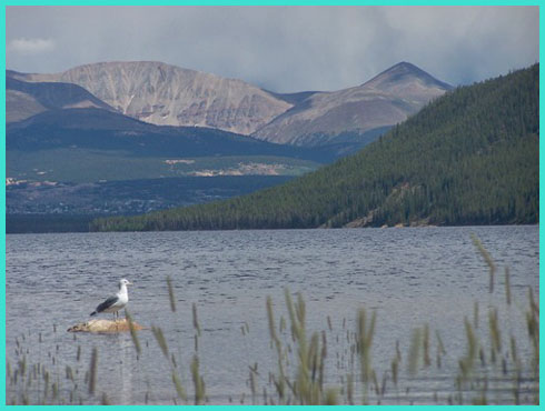
From North. A wide, shallow valley separates Leadville from the lake. At least it is shallow in comparison to the other landforms in this area. From the low point of this valley it is a 200ft climb to the damn of the lake. Conveniently, there are also two access roads from the valley bottom, both of which have been used as approaches in the profile. A already mentioned the relative absence of traffic is a main attraction. The northern side of the lake seems to be even quieter than the south side. It is more circuitous, and whatever Hagerman Pass bound traffic there is, uses the south side. In between forest meanders you come across vantage points over the lake, the Sawatch Range, Leadville and the Mosquito Range, and then you just keep on riding. The point of highest altitude is not marked in any way, neither is there a good view. It is located about three quarters towards the western end of the lake.
From South. (described downwards) This
approach is longer, so it should be gentler, since
it goes back to where we started, unless the road
rolls up and down like a roller coaster. It rolls
a little bit, but this side really is gentler. On
the west side of the lake you pass the Timber Line
trailhead, which can also be used to access
portions of the Colorado Trail, and a short paved
spur road down to the eastern portal of the
Charles Bousted water diversion tunnel. (See the
history section in the long version of the Hagerman Pass
page). Continuing on CR9, a gentle climb leads to
a intermediate high point, located at the junction
with FR105 to Hagerman
Pass. Rolling along further, the descent
contains a long open, treeless section with
uninterrupted view of the lake and the Mosquito
Range. This is the only section without trees
immediately next to the road on the loop. Crossing
the damn is a classic view of Mount Massif, and
then its just a short roll back down to the low
point. Dayride PARTIALLY PAVED / UNPAVED CR9 Turquoise Lake Rd s(u),
additional out and back: jct FR105 - CR9
Turquoise Lake Rd <> out and back to eastern
portal of Hagerman Tunnel > down southern side
of CR9 Turquoise Lake Rd > CR9c north > up
northern side of CR9 Turquoise Lake Rd > CR9
Turquoise Lake Rd s(u) > back to starting
point: 33.4miles with 2690ft of climbing in
3:10hours (VDO MC1.0 m3:11.8.25).
|
 Approaches
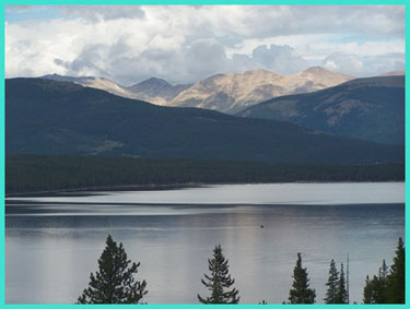
|
|
advertisement |
|
|
advertisement |