|
|||||||||||||||||
|
|
|||||||||||||||||
| |
Col de Porte
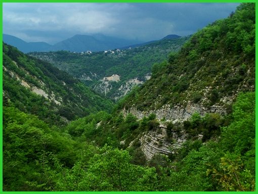
This pass connects the top of the col
Ste Roch with the Gorge of the Vesubie. Especially
approaching Col de Porte from from Luceram (with Col Ste
Roch as shoulder point) there is an amazing transition
between dry badlands topography to rain forest like
vegetation in the gorge. This is one of those wonderful
"extended Nice area" roads, that seems to hardly
have any traffic.
Looking for this crossing on a map, there is also a nearby Col de la Porte to the north of the Col de Porte. The former is only accessible by trail.
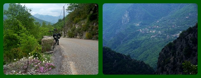
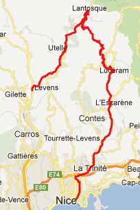
From West. From one view point Luceram is probably the most interesting point of this excursion, even if it is just at the beginning, of where the approach to this pass is often said to start. In order to maximize the elevation gain the profile above starts quite a bit lower. Signs in Luceram mention 4 passes: Col de Porte, Col de
l'Able, Col de l'Orme, and Col de
Turini. But only Turini gets the major league treatment from
the road signage. Periodically placed signs show the remaining
climbing elevation, distance, and current average slope. The
road up to the shoulder point Col
St Roch climbs into dry topography, directly across from
Luceram. The lower switchbacks are a great vantage point on the
town, from which the two distinctive church towers can be seen.
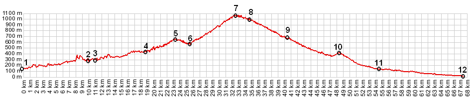
The most extensive series of switchbacks along the route are
near the top of Col Ste Roch. Past that the road to Col de Porte
becomes even less formal, just a wavy remnant of tarmac between
rough wooden guard rails, and climbs to the top between dry
forested hills. Unfortunately lots of small electricity towers
make photography of the pass difficult, unless the poles
themselves become the subject of the picture.
From East. (described
downwards) The long curvy descent takes a break before reaching
the hilltop village of Loda. Here the road climbs a little
before descending on a shelf into the Gorge of Vesubie. I was
surprised several times by meeting mountain sheep at stream
bridges during the descent. Descending further down the Vesubie
Gorge the traffic is now much heavier.
Dayride.
Col de la Porte , D19
Levens(sh) , Col de
Quatre Chemins: 177 bd observotoire, Nice > col
de Quatre Chemins <> out and back to end of route
strateqique from top >> Cantaron > D21 >
l'Escarene > Luceram > Col de Ste Roche(shp) > col de
la Porte > Loda > D19 south > D19 Levens(sh) >
Nice > sp: 69.2miles with 6720ft of climbing in 6:20hours (VDO
MC1.0 m4:12.5.13).
The first pass with different start and end points on this Extended
Tour is: Col
de Vence back to Cycling
Passes in Europe
|
 Approaches