| |
| |
D215 - D615 Berre-les-Alpes
s(u)
This is yet another
popular cycling summit in the Nice area, judging
from all the bikes I saw going up. This is part of
the greater metropolitan area and has more traffic
than the area immediately north of here. North of
the Col de Nice seems
to be the cutoff point for heavy traffic.
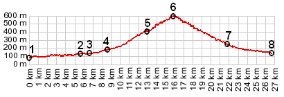
From East. The profile includes the most
direct way to get to the Col de Nice from la
Trinite, a suburb of Nice. Much of this route
carries quite a bit of traffic. More circuitous
routes to approach the Col
de Nice are better rides, for example using
its eastern approach or making a detour on the
western approach over Cd321 (see the Col de Nice page).
From the summit of Col
de Nice, the road continues to this unnamed
saddle in serpentines. The point of highest
elevation is at the junction with the short out
and back road to the town of Berre-les-Alpes. The
first picture shows the town from this approach.
It gives a selective view, ie it cuts out all the
construction cranes, modern houses, gas stations
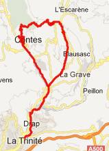
etc., all of which are not far away. From West. (described downwards)
There is at least one other small sideroad that
branches off about halfways down. It is also a
named pass. But taking that descent misses Contes.
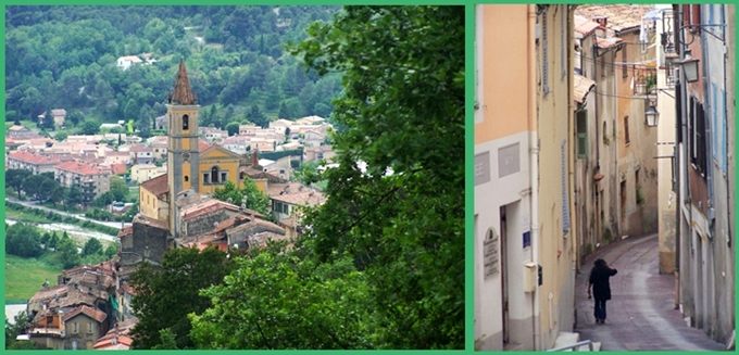
Approaching that town, the road skirts the
entrance to the medieval streets. No detour
required for a walk back into time.
History The hill occupied by
Berre les Alpes has been occupied since the 7th
century BC, according to finds relating to a
Celtic-Ligurian castelara. But the history of the
town begins in the 11th century. We can assume
that prior to this time shepherds from the village
of Berre Peille grazed their stock on the hill
during part of the year. Then a document from 1108
mentions the existence of seven castles, including
on this hill. A time of major improvements began
in 1355, when Gaspard de Berre restored and added
to the buildings.
Dayrides with this point as
highest summit:
D215 - D615 Berre-les-Alpes , additional out and back: 177 bd observotoire, Nice > col de Quatre Chemins(shp) <> out and back to Laghet > l'Escarene > col de Nice(shp) > Berre-les-Alpes s(u) > Contes > sp: 46.1miles with 4340ft of climbing in 4:16hours (VDO MC1.0 m4.12.5.14). The first pass with different start and end points on this Extended Tour is: Col de Vence |
 Approaches
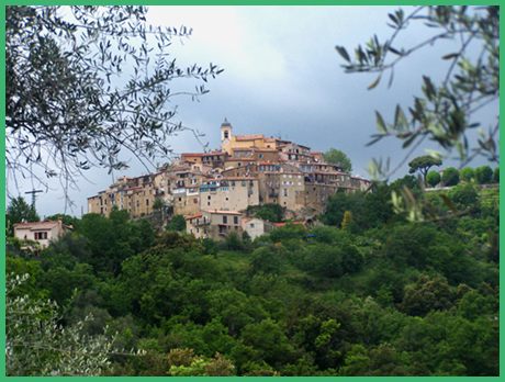
|
|
advertisement |
|
|
advertisement |