| |
| |
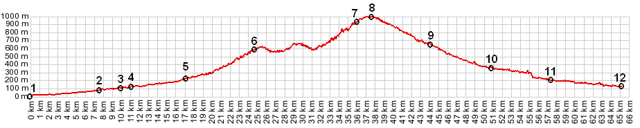
Col de Saint Roch Four roads meet on Col de Saint
Roch. Two of these go to higher named passes, Col de Turini and Col de Porte. More
often than not, Col de Saint Roch is just a
shoulder point on a ride to one of these two
summits, especially Col
de Turini. But even on a Col de Turini ride,
the part of the ride between Contes and Col du
Savel is (in my opinion) the second most
interesting part of the tour. (The first place is
still reserved for the Gorge de Piaon). But that
portion between Contes and Col du Savel is also
part of ride with Col de Saint Roch as highest
point. These two approaches, which make Col de
Saint Roch the highest point on a loop, are
described here.
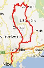
From South. In order to maximize the
elevation gain the profile starts on the coast and
follows busy metropolitan and suburban roads to
Cantaron. North of Contes cycling conditions
become much better. Soon the route passes one of
the main attractions of this ride, the hilltown
Coraoze. A turnoff to the right provides a short
detour through the narrow medieval alleys. The
cemetery on the highest point of this vallage has
the best view. More pictures of this town are on
the Col de Turini
page.
From North. (also described
upwards) The profile on this side starts at point
4 of the other approach. It follows a pleasant
cycling road to l'Escarene. An interesting far
view on this part of the ride is the hilltown of
Peille. A picture and the description of this
route is on the Col du
Nice page. The next major attraction is the
hilltown Luceram. The climb from here to Col St
Roch leads in serpentines up a dry sandy slope,
partially eroded into badlands at the top. back to
Cycling Passes in Europe |
 Approaches
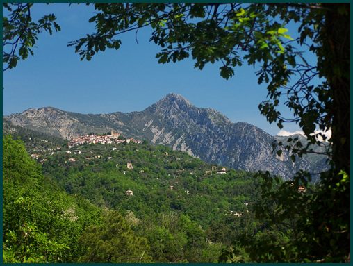
|
|
advertisement |
|
|
advertisement |