|
|||||||||||||||||
|
|
|||||||||||||||||
| |
Col de Nice
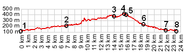
When coming down from the mountains, from Luceram or Sospel,
you hardly notice the col de Nice. It is only a shoulder
point with about 150ft of climbing. However, even if it's
not a steep climb, there is some very pleasant cycling to be
had further down on D21, which is really the lower eastern
approach to this pass, and far away from any traffic coming
down from the aforementioned mountains
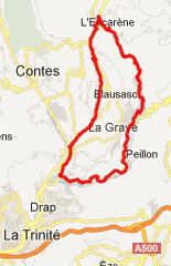
From West. The main road from Nice via Drap and
Cantaron is a busy suburban ride, but it is still easily bikable.
It includes a bike path, leading north around the housing
development of la Condamine. You find it automatically going
north to south, not quite so automatically south to north. But
the profile does not start until D21 branches off shortly
thereafter. Following the direct route shown in the profile,
D2204 up to the Col de Nice is not really a pleasant ride, due
to heavy traffic. A detour over CD321 makes a nicer ride. D2204
is less of a problem during a quick descent. There is no view of
any kind on top of the pass, no sign, and it is hard to see a
reason to stop. From East. (also described upwards). Following D21 has
less traffic than the other approach, but more traffic than the
mountain passes to the north. This road is busy with racing club
cycles on the weekends and has a bike lane much of the way. The
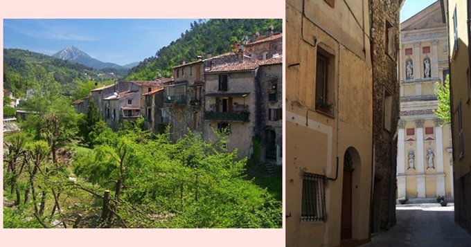
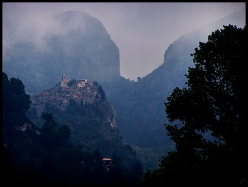
one jaw dropping sight along the way is a far view of the town
of Peillon (picture included), apparently clinging to some moss
on a stalactite like rock ahead. After that a short climb leads
through a rocky gorge into the outskirts of l'Escarene. At the
outskirts of this town a memorable road forks off to the right.
It is labeled as: "Les Tres, Les Champs and Chapelle
St Pancrace" and can be used as an alternate approach
option to Col des Banquettes.
Tours
A Dayride with this point as intermediate summits is on
page: col de la Porte
Dayrides with this point as shoulder point are on pages: Col de Turini , Col de Madone back to Cycling
Passes in Europe
|
 Approaches