| |
| |
Staller Sattel
aka Passo Stalle The Defereggental is a popular
hiking area in the Hohe Tauern National Park in
Austria. There is also a downhill ski area, but
it's a far cry from the ski run disected
landscape, that is typical for the large dolomite
passes. Two bikable passes connect this quiet
valley with Italy. The other one is Klammjoch, a
dirt road that is closed to general motorized
traffic. And then there is Staller Sattel, which
is not exactly a traffic thoroughfare either. Even
if the border is always open and unmanned, the
road is closed at night, and even then a large
portion on the Italian side is only open one way
in alternate directions. All this helps to make
this a quiet area with relatively little traffic
and an excellent cycling route.
 Approaches From East. From Lienz a smoothly
paved separate bike trail goes to Huben. Here a
steep climb leads to a tunnel. At its other end is
Hofgarden. During that initial steep climb a road
on the opposite side of the Tauerntal appears to
be climbing at least as steeply towards the
Schobergruppe Mountains. Past Hofgarden the grade
relaxes a bit, and the road follows the Deferggen
Valley into the Hohen Tauern National Park. Many
of the towns lie further up in the hills and
require quite a bit of climbing. An exception is
Sankt Jakob iD, which is an excellent base for
exploring the hikes and mtb climbs in the area.
The supermarket in the center of town across from
the war memorial has a better selection than most
stores in superbly scenic centers like this. Just
past Erlsbach the road splits between the Staller
Sattel and Klammjoch,
and the climb starts in earnest. The switchbacks
remain in thick forest until the road climbs into
a high valley and follows it almost straight to
the summit between large, pile like mountains
above treeline. The only two major turns lead
around a lake that many motorists use to take a
short walk. Tour buses can reach as far as the
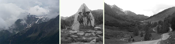
lake before they have to turn around. At the
summit has a enough room for a small statue before
you cross into Italy. From West. (described downwards) The road
from the summit to Antholzer See is a narrow one
way road that is open for departure for 15 minutes
out of the hour in each direction. The access is
controlled by a traffic light. Weather you get to
the other end of the one way stretch in the
allotted time is up to you. The road also leads
through a narrow 40m tunnel. When two vehicles
meet inside in opposite directions it presents an
interesting traffic situation. Antholzer See is a
lake surrounded by cliff forming mountains on
three sides. It has a laid back luxury hotel feel
to it, none of the circus that is common, when ski
resorts are present. You pass the training center
for Italian biathlon teams at the end of town.
From here a fast roll leads down a wide valley
(Antholzer Tal), while the divide between Austria
and Italy behind seems grows in size and
precipitousness from this new perspective. When
joining the next larger valley (Pustertal) you can
pick up the bikepath (Drauradweg) in either
direction. The path does contain a few unpaved,
but well drained and very smooth dirt sections. A day on a tour with this
point as highest summit:
(<Kartitscher Sattel|Jaufenpass>) Staller Sattel: Sankt Jakob iD > Staller Sattel > Bruneck > up the Drauradweg > Bruneck > Kiens: 43.6 miles with 3100ft of climbing (VDO MC1.0 m4:9.6.26). Notes: includes a fairly long room search. Dayrides from the endpoint of this day, Kiens, are on pages: Wuerzjoch Furkelpass
|
|||||||||||||||||||||||||||||||||||
|
|
advertisement |
|
|
advertisement |