| |
| |
Kartitscher Sattel
As the designation hints, this
summit is a relatively gentle saddle between
converging valleys. The two approaches have very
different characters: one long, scenic up and down
roller coaster through the fascinating villages of
the Lesachtal, the other side a quick
unproblematic climb to the top.
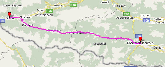
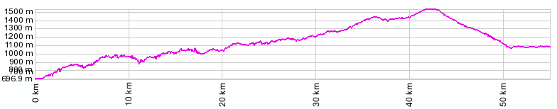
From East. Leaving
Koetschach-Mauthen the road climbs steeply up the
south side of the valley in order to pick up the
first town. Then it descends again, crossing a
mountain stream on an impressive bridge. But the
valley floor managed to pick up elevation too, and
so the descend is not nearly as low as the
starting point. This description could be
repeated, what seems innumerable times, but really
is about 4 or 5 times. Each time the valley
becomes shallower, the descends and bridges
smaller, but the villages plastered high up on the
ridge remain as picturesque with their church
steeples and their many stately pensions. Don't bother counting ski areas on this pass (or
saddle). There are some, but they are well hidden
and don't employ ski overruns to cross the road.
Instead it might be interesting count crucifixes,
of which there must be hundreds. But you can't
seem them all unless you traverse all the little
towns next to the road. The most impressive
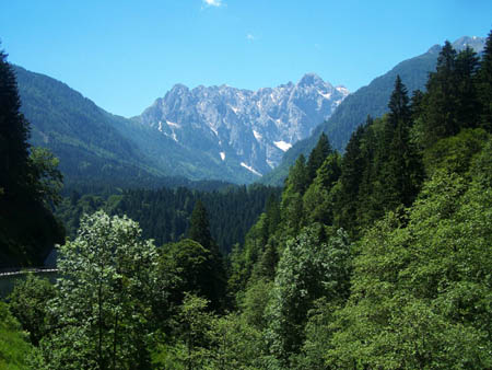
mountain vistas are further down on the approach.
As you climb further up, the high valley catches
up in altitude, not only with the mountain ridges,
but also with the road, so that further up, the
road is actually closer to the valley floor. As
you approach the top, If if were not for a few
glimpses above, the surroundings could be mistaken
for a small forested valley. There is sign at the
top of the saddle, but the highest point is
reached a little later and is just a few meters
higher.
From West. It may take some convincing to
leave the comfortable bike path following the
river Drau (Drauradweg) in the valley between
Sillian and Lienz to climb up to this saddle. Not
that there is a lot of traffic on this road, but
cycling on this meticulously paved and signed bike
path is very nice indeed. The switchbacks on the
climb improve the view of the valley and finally
passes through the town of Kartitsch. Here the
church makes a great foreground to the ridge
behind it. Just a few more km of moderate climbing
and the top of the saddle is reached. No ski
lifts, no special views, but peaceful mountain
forests and meadows. A Dayride with this pass as intermediate
summit is on page: Tilliacher Joch Extended Tour:
(<Ploeckenpass|Staller Sattel>) Kartitscher Sattel: Obertilliach (which is close to this summit) > Lienz > Defereggental > towards Staller Sattel as far as Sankt Jakob iD: 59 miles with 3300ft of climbing in 5:4 hours. (VDO MC1.0 m3:9.6.22). A Dayride from the endpoint of this day, Sankt Jakob iD, is on page: Klammjoch. 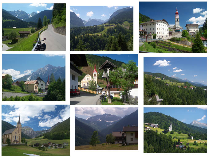
|
||||||||||||||||||||||||||||||||||||||||||||||||
 Approaches
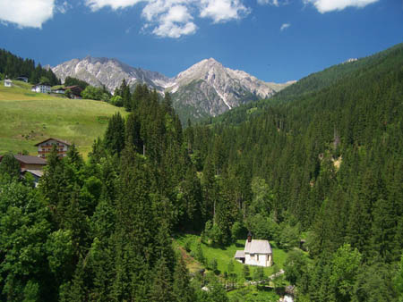
|
|
advertisement |
|
|
advertisement |