| |
| |
Furkelpass
(aka Pso Furcia) Furkelpass is a relatively short
loop through the northern end of the dolomites
near Bruneck. This pass does not show up on all
maps. Kompass hiking maps label it as
Furkelsattel, on some road atlases of the alps it
does not show up at all, and at least one Italy
atlas labels it as Furkelhoehe. All the signs in
the area call it Furkelpass.
Approaches From West. The initial approach
from the valley is the same as riding up Wuerzjoch . A
series of 4 long tunnels south of Sankt Lorenzen
can be bypassed on sections of an old abandoned
road. This makes the ride up very pleasant, scenic
and quiet. On an ascent the bypasses are all on
the right side, so no time is lost crossing the
road. In Zwischenwasser the road to Furkelpass
heads straight aiming for the ritzy ski resort of
Sankt Vigil, while the route to Wuerzjoch turns
off to the left. Meanwhile the first dolomite
cliffs appear behind the facades of ski hotels and
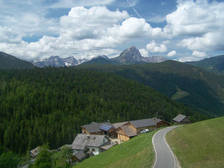
lifts. In Sankt Vigil the road turns steeply up
the left without really entering town, and now the
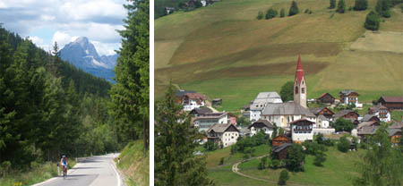
major visula attractions are villages at half
height of the valley, each with at least one tall
church towers sitting in clusters of stately
houses and barns fit to be mansions in other parts
of the world. Looking at them from across the
valley, flattened like on a piece of paper, the
buildings appear like an illustrated map of the
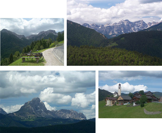
village. As the road switches back and forth the
Kreuzkofel Gruppe and the peaks in the Wuerzjoch
area come into view. They disappear as the road
enters the forest and soon goes under a ski-over
bridge, labeled Furkelpass with a somewhat lower
altitude than the official figure. More ski
buildings follow, then another short climb to a
parking lot where the official sign with the
correct altitude is located. There is a trailhead.
All ski area buildings are a little lower.
From East. A fast descend soon opens the
view up the Niedertal with the border to Austria
and Staller
Sattel. Turning back, a few dolomite cliffs
can still be seen, but this is their northern end.
Here too there's a ski bridge. In Olang you can
pick up the bike road in the Pustervalley,
connecting to other points in East and South
Tirol. Tours Dayride:
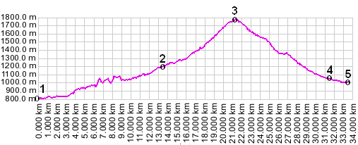
Furkelpass: Kiens > Furkelpass > Olang >Bruneck > sp: 38miles with 4000ft of climbing in 4 hours (VDO MC1.0 m3:9.6.28). Notes: This is a loop with an additiona 6km out and back approach from Kiens. Includes about an hour of sightseeing in Bruneck. The last day of this Extended Tour, ending in Kiens, is on page: Staller Sattel
|
||||||||||||||||||||||||||||||||||||||||||
|
|
advertisement |
|
|
advertisement |