| |
| |
Penser Joch
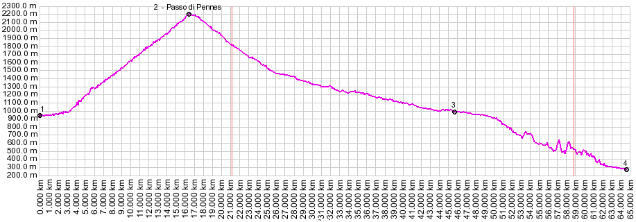
When other high passes in the alps are still closed in the spring, the Penser Joch is often open. During end of May/09 Groedner Joch, Timmelsjoch and Stilfser Joch, all not very far away and reaching above 2000 meters, were still closed. But this superb climb into the Sarntaler Alps was open. The south side has a very large elevation drop and an impressive tunnel route. 
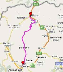
From North. On the south end of Sterzing
(Vipeteno) a veritable forest of pass signs is
located around a rondell. One of them is Penser
Joch. The small road begins to climb steeply right
away, high above the caravans of trucks in the
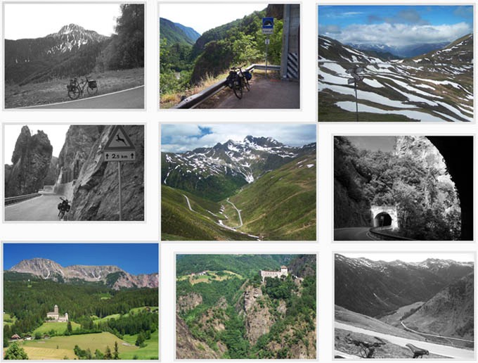
valle d'Isarco. A prominent triangular peak soon
dominates the view above, the Tagewaldhorn
(2708m). With the help of a few switchbacks and a
straight long cut above treeline the road climbs
to the restaurant at the top. My map labels
one stretch as a 20% climb. But I did not
encounter anything that steep, and I think I would
have known if I did. The climb is relentess and
steep, but not that steep. From South. (described downwards). This
side is higher, longer, gentler, and straighter,
generally speaking. Two ramps switch back down the
the base of the Weisshorn (1705m). One more steep
step down to Asten and the road is in the
Pensertal. Now a loaded touring bike rolls along
comfortably, not much breaking required, not much
pedaling either. The attractive town of Sarntheim
(Sarentino) is worth a detour, even if it's just
for the improved view of the castles, high up on
the west side of the Pensertal. A few km later and
the valley becomes a deep gorge with 19 tunnels
carving their way down into Bozen. The space
between the tunnels is at times only a fraction
the length of the tunnels, which make some places
between tunnels quite exciting perches over the
landscape. I was going to gloat that only cyclists
have the luxury to stop fast enough to take a
closer look. But after stopping my bicycle fast
enough, I noticed that one small balcony was also
a bus stop, apparently serving the tramway to a
nearby house on a cliff. The last tunnel emerges
close to the heart of the old mountain city of
Bozen, at the castle of Roncolo. A impeccably
paved and white lined bike path soon picks up to
the left of the road and leads along the river
Eisack. The city center and tourist information
are to the left over a metal bridge.
|
||||||||||||||||||||||||||||||||||||||||
 Approaches
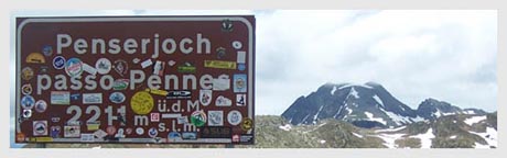
|
|
advertisement |
|
|
advertisement |