| |
| |
Mendelpass
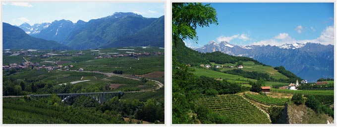
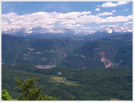
aka Passo della Mendola The Mendelpass area is a balcony
on whole groups of mountains in three different
directions, the dolomites behind Bolzano, as well
as the Ortler group and the Brenta group of the
alps. Large groups of bikers of all kinds,
motorized and unmotorized are likely to be on this
road. Beware of route finding problems when trying
to make a southern loop back to Bozen.
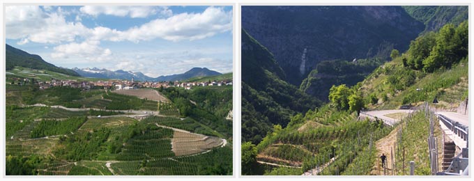
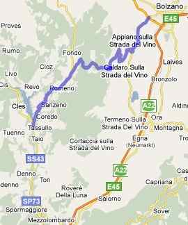
From East. There are several
options for the lower approach. But they all leave
from the valley of the Etsch, starting as far
north as Andriano or as far south as Kaltern (or
even further south on narrow secondary roads). The
closest metro area is Bozen to the north. Leaving
Bozen towards St Paul and St Michael, you can take
a bike trail from the south side of town that
passes through two bicycle tunnels while climbing.
These are nicely lit tunnels, away from cars and
motor fumes, a whole new pleasant tunnel cycling
experience. In St Michael the objective of the
ride becomes visibly clear. It is the large green
plateau on the west side of the Etch river. The
road works itself up the plateau with methodical
ramps that are like stepping stones, each one
neatly labeled with a number and the altitude for
the many cyclists that make the climb. The rocky
dolomite spires, sitting on top of a green plateau
on the other side, are visible even from the lower
ramps and from there the view only gets better.
The ride becomes especially memorable, once it
reaches the upper cliff forming formation. Here
the road becomes a long curvy shelf, and a solidly
built stone fence separates the road from the drop
off. Little alcoves, like bird's nests above the
landscape, seem like the perfect impromptu
stopping point for a bicycle, unless the traffic
is relentless. Now it's several more switchbacks,
these ones stacked on top of one another so that
they all fit into a single photo from the top, and
then the actual top is reached, where a whole town
waits, complete with restaurants, an alimentari,
bars, albergos and souvenir shops, even a
funicular. I'm told they take bicycles, and
several have been seen standing close by, but
nobody admitted to actually taking the funicular.
From here there is an option to climb further for
an out and back ascent to Monte Penegal (1737m).
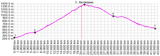
Dayride with this pass as the
highest summit:
Mendelpass: Andrian (a few km south of Bolzano) > sightseeing detours through Sankt Paul and Sankt Michael > Mendelpass > descending along multiple wrong turns and dead ends eventually continuing > Tuenno > Nanno > Flavon > Denno > Mezzocorona > Weinstrasse bike path > Bozen > Andrian: 103 miles with 6000 ft of climbing in 8:2 hours (VDO MC1.0 m4:9.5.27). Notes: without the detours, planned and uplanned this would be a much more reasonable day ride. A dayride with this pass as intermediate summit is on page: Gampenpass The last day on this extended tour with different start and end points is on page: Penser Joch 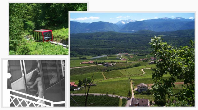 The bottom two picture
pannels were taken on the bottom part of the
described western approach, direction Nanno,
Tueno and Derinno. Many other options exist.
|
||||||||||||||||||||||||||||||||||||||||||
 Approaches
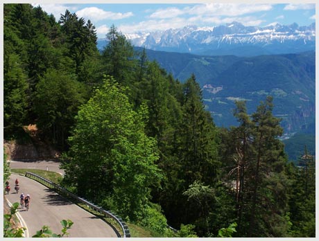
|
|
advertisement |
|
|
advertisement |