| |
| |
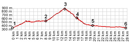
Col de la Forclaz
There are at least
tree passes with this name marked on my Michelin
map of the Rhone-Alps area. This one is a small
short cut, that connects Queige in the Doron
valley with Ugine in the Gorge de l'Arly.
From South. A sign at the rondell
below Queige points the way up to Col de
la Forclaz. Queige sits a short distance up the
valley, a group of houses huddled together around
a church tower. The road is fairly narrow and has
little traffic, except during rush hour. It stays
in the forest with few views on this side. Instead
it is a nice quiet ride through the forest. On top
is a sign, a few houses scattered nearby, and
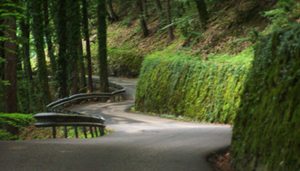
another paved narrow track leading higher. From North. (also described upwards). The
turnoffs to Col de la Forclaz and Col de l'Arpettaz
from N212 are at the same location in opposite
directions. Col de la Forclaz climbs steadily
above the factories and row houses of lower
Urgine. For a short time the road enters dense
forest and runs along a fairly high brick wall,
built to stabilize the hill. About half ways up it
meets an alternate approach from lower in the Arly
valley. More switchbacks in the forest lead to the
top
Dayrides
with this pass as intermediate summit are on
pages: The last pass with different end and starting
points on this
Tour is: Cormet
de la Roselend
|
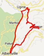 Approaches
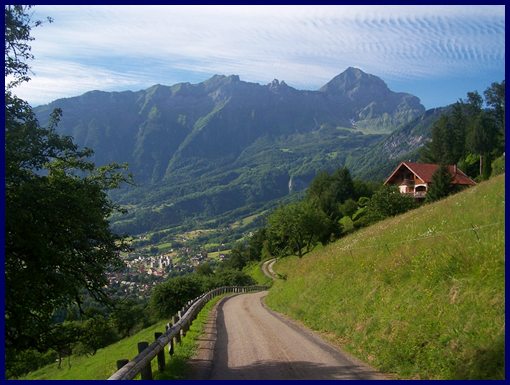

|
|
advertisement |
|
|
advertisement |