| |
| |
Col des Champs
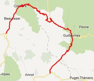
If starting in
Barcelonnette, this is the middle pass in the
classic Allos
- Champs - Cayolle
loop, in either direction. Here the ride has a
more isolated feel to it than on the other two
passes.
From East. After descending
Col de Cayolle,
most first time cyclists look anxiousely for a
small turnoff to the right, just after the village
of St Martin d'Entraunes. The profile starts lower
in the Vars valley to maximize the elevation
approach. I did not ride this lower part.
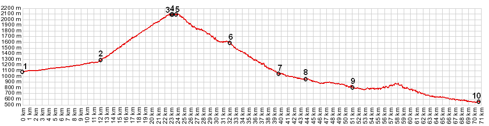
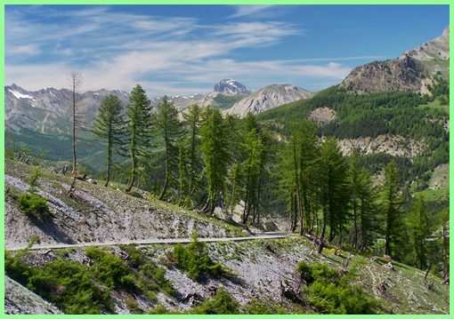
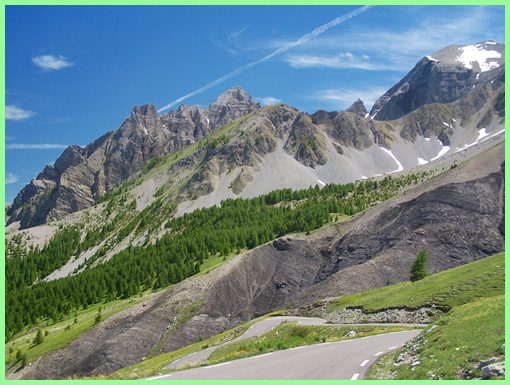
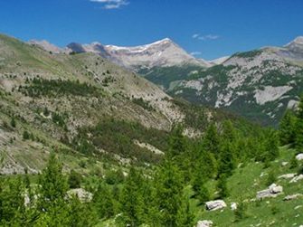
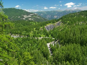
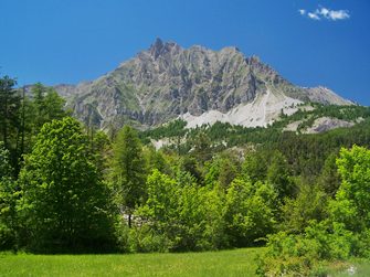
The pass itself is a grassy saddle,
hence the name "The Pass of Fields". It contrasts
with the dramatic, adjacent group of sky piercing
peaks of the Sommet de la Frema (2747m). Remaining
distance and elevation signs give the cyclist
excact information how much work he has left to
do. The general large scale of the surrounding
landscape made it difficult to estimate how much
effort was left to reach the summit. When the sign
said 5km remaining, it was hard to believe. I
thought I was practically on the pass already. The
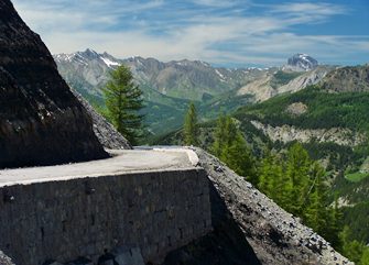
road reaches a slightly higher altitude before and
after the pass. The official highest altitude of
the road is 2087m, that of the pass 2045m. The
pass is signed - no buildings otherwise. From West. The road surface
becomes much worse at this point, and I was
actually wondering if the fact that I had my
mountain bike with fat tires was advantageous. The
first few curves past the top are especially
interesting. The new viewshed comes into sight,
and the road is held in place by a much more
temporary looking construction, that what I had
come to expect from the civil engineering marvels
of alpine passes. The road is held in place by
temporary looking embankments, and a mountain
creek crosses the road in a constructed drainage
crease. It contained still a consisiderable flow
of water during the beginning of June.
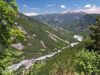
After the descend enters the forest
the views disappear and the road remains rough. I
met one automobile on the entire descend. He
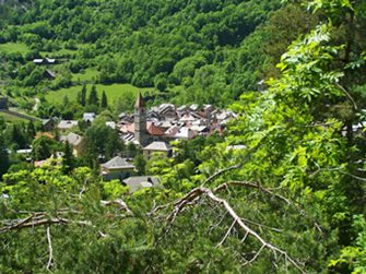
appeared very disgruntled. The village of Colmars
has an old castle and a medieval appearance. I am
sure it would be worth a longer look around. But
now well into the Cayolle - Champs - Allos loop,
the length of this ride was becoming more
apparent, and it was time to continue riding hard.
If coming from the other direction this turnoff up
the western side of Col des Champs is easily
missed. The elevation profile continues lower all
the way to the valley route followed by N202.
History Cycling - Tour de France: These
days it may be hard to believe that once upon a
time the Tour de France crossed a road like this,
or more specifically a road surface like on the
western approach. In 1975 the day's route started
in Nice and ended in the ski resort Praloup near
Barcelonette. The route also crossed Col d'Allos.
Belgian Eddy Merckx took the lead at the top, but
lost it by the end of the Tour. A
Dayride over this pass as intermediate
summit is on the Col
de Cayolle page. |
|
|
advertisement |
|
|
advertisement |