| |
|
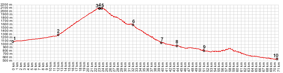
01.(00.0km,1086m) START-END WEST ALT: jct D52 - D908, nortwest of Thorame Haute
02.(12.0km,1264m) START-END WEST: profile turns right after Colmars
03.(23.1km,2100m) aproximate high point before pass
04.(23.4km,2087m) TOP: Col des Champs
05.(23.7km,2100m) aproximate high point after pass
06.(32.2km,1540m) turnoff to Pra Pelet on left
07.(39.6km,1041m) START-END EAST: profile turns right onto D2202 in St Martin d'Entraunes
08.(43.8km,942m) Villeneuve d'Entraunes
09.(51.0km,787m) Guillaumes
10.(70.5km,528m) START-END EAST ALT: jct: D902 - N202, west of Entrevaux
|