| |
|
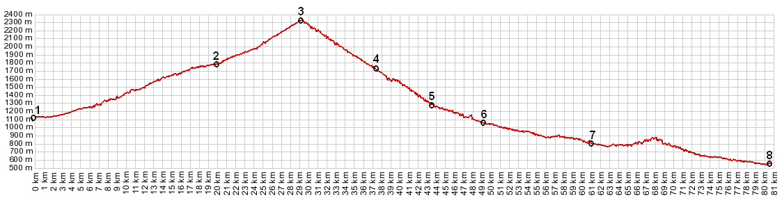
1.(00.0km,1133m) START-END NORTH: Barcelonnette, bridge over Ubaye
2.(20.0km,1785m) bridge over Bachelard, just after turnoff to Bayasse
3.(28.9km,2326m) TOP: Col de la Cayolle
4.(36.4km,1770m) Estenc
5.(43.5,km,1257m) Entraunes
6.(49.2km,1039m) START-END SOUTH: turnoff on right goes to Col des Champs, profile continues straight into Saint Martin d'Entraunes
7.(61.0km,796m) Guillaumes
8.(80.2km,547m) START-END SOUTH ALT: jct D902-N202 ,west of Entrevaux
|