| |
| |
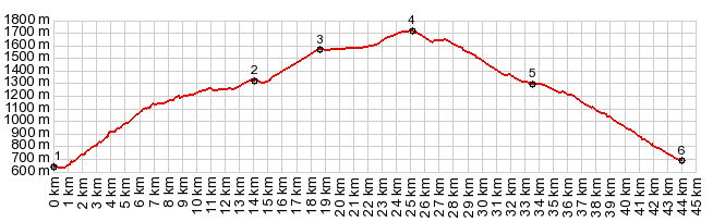
Port de Canto
This pass is a demonstration, that
popular cycling passes do not necessarily have to
be the steepest, or lead through the most vertical
and surrealistic rock scenery known to cyclists.
In spite of the fact of its relatively high
elevation, Port de Canto is quite the opposite.
Maybe it's this special position that makes out
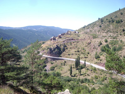
its charm. It is a smooth, modern road, but with
little traffic, along a big breadloaf in the sky,
overlooking what looks like a big green paradise
from up here.
After a good workout, and the junction with an
unpaved route down from Pic
d'Orri s(u), the road levels out, even drops
a bit. At this point the road makes a big detour
to the south, by contouring along a big gentle
forested nose of a landform, the Serrat de Carla.
The rest is soon forgottoin, andt he climbing
resumes. There are only two minor additional
switchbacks to take your mind off the road. It is
such a workout, that the viewpoint at point 3, is
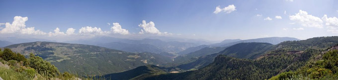
a great break, and a scenic relief too. This is
the best scenery view along the way, in my
opinion. To the south and west lies a big gentle
forested valley dominated by pillow like
landforms. Only if snow adorns the higher ridges,
do they take on a foreshortened harder look. After relaxing a while and then leaving this remote parking lot view point, I am wondering if this was not actually the summit. While the profile shows the road climbing gently from here, in truth the road does sometimes go downhill for short sections along this long gentle traverse, that seems like it goes along a forested breadloaf in the sky. The pass itself is very apparent. as I approach it in a straight line, a gentle gap between two rounded knolls.
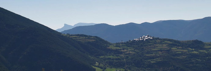
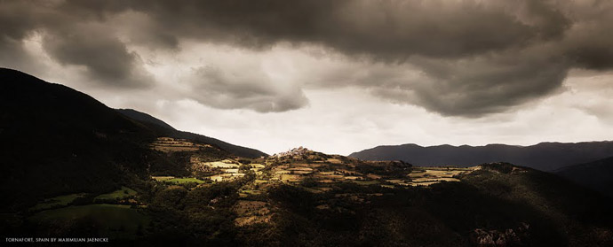
From West. There are
few hill settlements on this side, but mostly the
villages are more modern vacation businesses.
There are one or two exceptons, and one of them
looks quite spectacular, the village Tornafort at
almost 1300 meters height. located on the other
side of a wide valley. I can see from the pictures
on Panoramio, that many others have been impressed
by this view as much as me, and that they had
better light than I did. A Dayride with this point as highest summit: ( < Collado de la Trava | La Paquera s(u) > ) PARTIALLY PAVED / UNPAVED Collado de Canto x2: La Seu Durgel <> Pallerois <> Collado del Canto <> Soriguera <> turnaround point just beyond Puigformiu Notes: the only unpaved part is before the turnaround point, while looking for good picture points onto Tornafort, which was also the best part of the whole ride A Dayride with this point as intermediate summit is on page: Pic de l'Orri s(u)
|
|
|
advertisement |
|
|
advertisement |