| |
| |
Collado de Trava
This is the antidote to riding in
Andorra. These mountains are not as high or as
bare, or as steep. But from a joy of cycling
standpoint, this is where it's at. Lots of curves,
lots of trees, lots of climbing, good far views,
surprising hill towns, and hopefully pretty good
weather. This road is relatively wide in most
places. The most patched section is the middle of
the northern approach. Otherwise it is excellently
smooth.
From South. (described
downwards) Another old village soon competes for
attention Adraen. But if the route continues
direction Tuxent, the towns along the way are just
going to get more interesting. The next small
junction is Collado de Banks. Going right here is
a short cut to Collado
d'Arnat. However the profile takes the long
way, and it is also the more interesting one,
leading by the villages Farnois and Cornellana. In the course of the ride between here, then
taking a next right to a low point between this
pass and Collado d'Arnat, Cornellana appears from
pretty much all sides, and that includes from
above and from far below. Not sure which one I
like better.
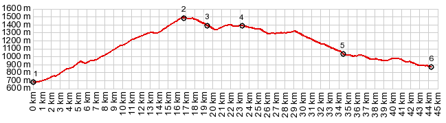
Dayride with this point as highest summit: PARTIALLY PAVED / UNPAVED ( < Collado Ordino | Puerto de Canto > ) Collado de la Trava , Collado d'Arnat s(u) , additional out and back : La Seu d'Urgell > El Cres > Collado de la Trava (1480m) > Adraen > Col de Banks (1369m,shp) > Farnois > Cornellana <> out and back to Tuxen <> separate out and back 4km one way towards Josa del Cadi >> Sorribes > Collado d'Arnat s(u) > Montan > N260 north > Adrall > back to starting point in La Seu d'Urgell: 67.6miles with 7121ft of climbing in 6:46hrs (garmin etrex30 r5:19.5.18) |
|
|
advertisement |
|
|
advertisement |