| |
|
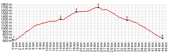
1.(00.0km,0650m)START-END EAST: Adrall
2.(14.5km,1320m)jct with dirt road coming down from Pic d'Orri
3.(19.1km,1570m)Port de Canto veiwpoint
4.(25.6km,1725m)TOP: Port de Canto
5.(34.3km,1300m)turnoff to Tornafort on right
6.(44.8km,700m)START-END WEST: Sort
|