| |
| |
Col des Borderes
This pass is on a parallel route to
the lower eastern approach to Col d'Auisque,
following D918. The route to Col des Borderes has
less traffic, and also fewer interesting views
than D918, making this a great repeatable workout
ride.
A quiet peaceful road climbs through the forest.
After parting ways with the route to above 3000m,
a few steep switchbacks lead to a summit meadow.
There are however no far views
From East-2. A few
quick turns lead into Arrens-Massous, site of a
curious looking hotel in a small village. Past
Aucun the profile on this side follows the
relatively heavy traffic of D918 back down to
where the south profile leaves it. 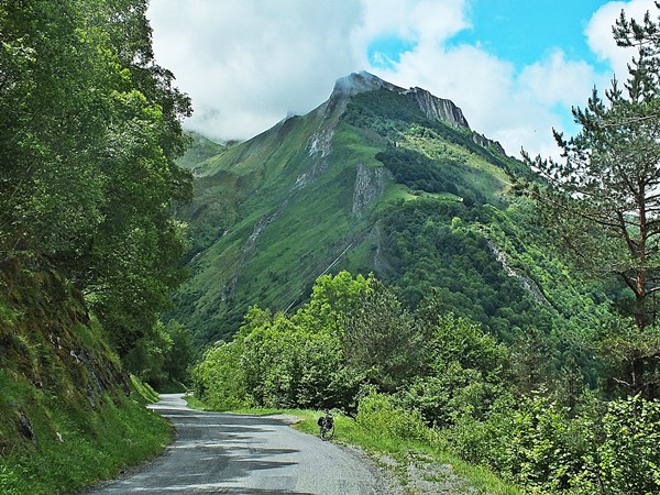
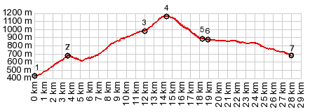
COMPLETELY PAVED ( < Segus s(u) | Cirque de Troumouse(ow) > ) Col des Borderes , Salles s(u) : Boo-Silhen > Labat d'Aucun > Col de Borderes > Arrens-Massous with sightseeing detour > Aucun > D918 east > Gez > Ayaz-Ost > Salles s(u) > Ouzous > Vidalos > bike path south > Arzeles-Gazost with slow sightseeing detour > back to starting point in Boo-Silhen: 33.6m with 4124ft of climbing in 3:33hrs (garmin etrex30 r5:19.6.11) Notes: The Salles s(u) summit has a signed trailhead to Pic de Pibeste in Salles. Apparently one of the best viewpoints from the foothills into the central high Pyrenees - also a trailhead to Col d'Andorre in Sere. History Cycling - Tour de France: Surprisingly this small road through relatively normal scenery - normal only when compared to these locally generally spectacular surroundings - has been used as a Tour de France summit, three times, in 1987, 89 and 2018. Maybe the reason is, that there are just so many higher nearby summits for, which this is the perfect addition to make a total killer stage, such as the Col de Tourmalet and the Col d'Aubisque 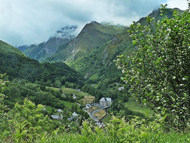 |
|
|
advertisement |
|
|
advertisement |