| |
| |
Col d'Allos
On a north-south
tour, this pass can be an alternative to Col de Cayolle.
Both of them are part of the classic one day loop:
Cayolle - Champs - Allos.
Of the three, this is the one road with most of
the automobile traffic and the ski resorts.
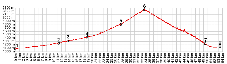
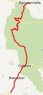
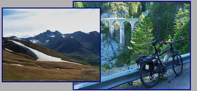
From South. The ride between
Colmars and Allos has a little more traffic on it,
than one has come to expect by now on the Cayolle
- Champs - Allos loop. The town Allos has a
supermarket along the road (but closed on Sunday)
that offers the opportunity to purchase a few more
calories for the remaining climb. The scenery
remains in a natural, harmonious state past the
next small village. Then it becomes dominated
completely by ski resort condominiums. After
passing under a ski run, I was wondering if I had
taken a wrong turn somewhere and the road would
dead end at a lift ticket station. It was hard to
imagine where this road could climb out of the
valley in the relatively short distance that
cyclist directed signs had advertised a few km
back. But, even though hard to believe, I was
still on the Col d'Allos approach. The road now
becomes much smaller and climbs in ramps to the
right up a steep grassy slope. This is not one of
the solid, old wall supported road beds, that are
common further south. But the road still crosses a
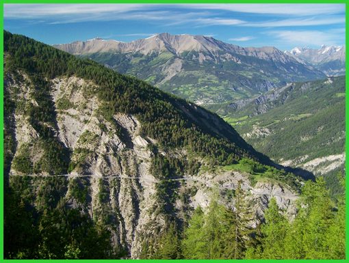
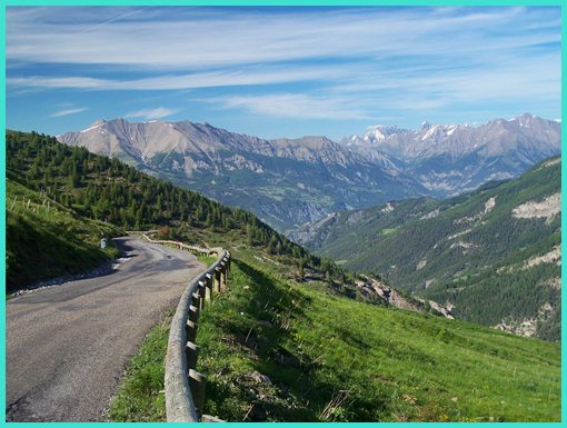
large number of drainage embankments. From North. (described
downwards) The view from the top now leaves behind
the ski area constructions. Looking down to the
north is especially impressive with late light.
The road makes a large loop to the west, and on
the opposing side you recognize a lower part of
the road, as it cuts across the middle of a cliff
face. The day becoming very late now, soon you are
traversing that section and are looking up the
gorge of the Bachelard, where the ride began early
in the morning. Now the road descends into forest,
crosses a picturesque stone bridge and keeps on
descending all the way into Barcelonnette to
finish a glorious day.
Historical Notes: Like many of the passes in this area
it owes its reason for being to military
strategies, involving the defense from Italian and
German attacks. Allos opened in 1891, that is 22
years before another option to cross this ridge
via the Col de
la Cayolle was added. This idea to have two
alternate routes on strategic ridge crossings was
also applied when the vulnerabilty of nearby Col de Vars was
reduced by constructing the Parpaillon tunnel
crossing.
Cycling - Tour de France: Unlike
the other two passes on the Cayolle - Champs - Allos
loop, this one has been on the Tour de France
route 33 times until the year 2000. Only 8 of
these crossings happened in the post WW2 period. A Dayride with the Col
d'Allos as intermediate summit is on the Col de la Cayolle
page. The last pass ride with different start and end points on this Extended Tour is: Col de Larche 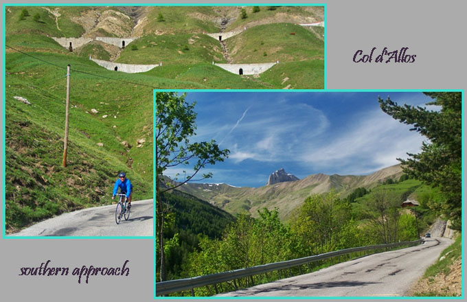
|
||||||||||||||||||||||||||||||||||||||||||
|
|
advertisement |
|
|
advertisement |