| |
| |
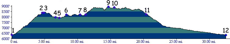
Four A Ridge Rd s(u)
The Douglas
Pass Road does not remain on top of the Roan
Plateau very long. But the Four A Ridge Rd
does. It makes a perfect vantage point onto
Douglas Pass Rd from above, as well as the ridge
lines into which the plateau has eroded. But it is
a dirt road and in order to make a loop over this
point, you really need a mountain bike.
Ridge Road itself appears well used, but not
heavily. I never encountered another vehicle. From
this low point the track climbs again steeply. The
next intersection is important. You have to take a
left on BLM1242, and this time there is no Rangely
Loop bicycle trail sign to point the way, as there
has been so far. This track seems to turn in the
wrong direction - east. A smooth roller coaster
track through woods and thickets contours around
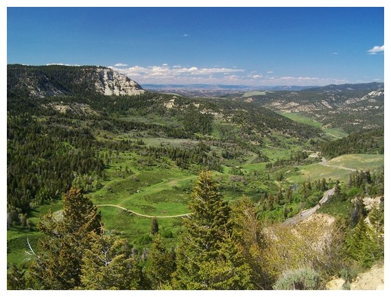
Scare Mountain (8856ft). On its north side are the
last excellent views of Cathedral Bluffs before
the double track trail takes to the bushes. Much
elevation is accumulated but not much is gained.
On the south side of the mountain the track
becomes more of a regular road and progress
becomes much quicker. Now the only thing between
here and the summit is an endless seeming
procession of short climbs and descends. Finally a
metal dome of a transmission facility becomes
visible. The highest point is the bump in the road
before the turnoff to the dome.
From South. (described
going down) In typical western
hospitality trespass of the road to the summit of
this transmission facility is prohibited by law
and prosecution is threatened. All I wanted to do
is enjoy the view. Even though this side is supposed to be downhill,
there are several more short climbs, which somehow
seem larger than they really are this late in the
ride. The road now follows the dividing main ridge
of the Roan Plateau with large dropoffs on each
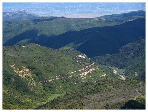
side of the road The last descend offers views
stretching from a lip shaped Grand Mesa in the
distance to the La Sal Mountains in Utah in the
other distance, and much closer: all the scenic
curves that Douglas Pass has to offer can be
juxtaposed together in a single photograph. The
last part of Four A Ridge Rd is a wide industrial
size dirt road. Dayrides with this point as highest summit: PARTIALLY PAVED / UNPAVED Four A Ridge Rd s(u) , Brushy Point s(u) : beginning of Rope Canyon Rd > up Rope Canyon > Brushy Point s(u) > Ridge Rd south > BLM1242 around Scare Mountain > Four A Ridge Rd s(u) > Douglas Pass(shp) > Co139 north > back to starting point: 35 miles with 4500ft of climbing in 4.1 hours. (m2:02.xx.xx)
Four A Ridge Rd s(u) , Douglas Pass , Brushy Point s(u)
: short distance up BLM1056 to Oil Spring
Mountain > dwon BLM1056 > Co139 north >
CR27 following Douglas Creek east > Brushy
Point Draw south > Brushy Point s(u) > Ridge
Rd south > BLM1242 around Scare Mountain >
Four A Ridge Rd s(u) > Douglas Pass <>
out and back down south side with turnaround
~330ft below summit > Co139 north > back to
starting point: 53.3miles with 5280ft of climbing
in 6:14hrs (garmin etrex30 m5:17.5.28).
|
|
|
advertisement |
|
|
advertisement |