| |
| |
Tommy's Draw s(u)
The Roan Plateau seems like
landscape of patterns with few outstanding
landmarks. At least it appears that way when
staying on paved roads. The Cathedral Bluffs,
south east of Rangely, are one of those
outstanding landmarks, that don't immediately
present themselves to paved road travelers. The
Cathedral Bluffs are surrounded by patterns of
hills. This good unpaved road traverses along
these cliffs at half height. There is also a path on the top of
this cliff bordered plateau. But to pick up that
route you have to descend more than a 300ft from
the Tommy's Draw road. So Tommy's Draw is a summit
instead of a shoulder point and gets an s(u).
The map shows several options to get to half
height. But once in the landscape itself,
the most obvious seems to turn onto CR128, where a
sign warns that there will be no more traffic
signs along the route. For now the slightly soft
dirt road stays in a narrow draw and crests
between the pinyons in order to descend into a
small ravine. Here cows make a ruckus as if they
owned the place. Soon the route begins to climb again and a
continuation of the track, cutting its way along
the bluffs becomes visible. The highest point is a
dry stream crossing, imaginary water tumbling down
from the white cliffs. But I think I'd rather be
here when it is dry. 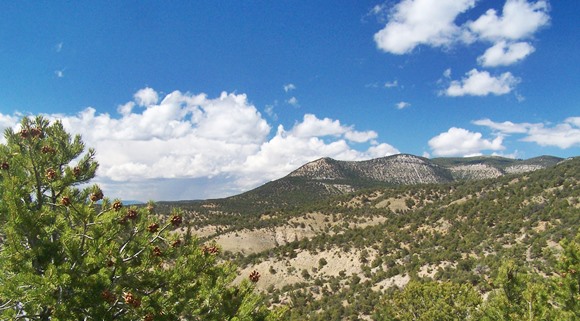 From East. (described
downwards) But this is just the beginning of a
long traverse. To the right the white cliffs
become gentler, and slowly recede away from the
smooth path. To the left the landscape falls off
into rolling hills of brush forest. The Uinta
mountains form a jagged white line at the horizon.
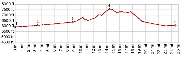
Actually the traverse lasts longer than the
profile does. At the signed junction of BLM1250
and CR128, the profile elects to descend down
BLM1250. Arriving at the bottom of this bumpy cowtrack,
you have the choice of going upstream or
downstream along Douglas Creek in order to cross
it and rejoin CR28. Downstream may be shorter but
the upstream option has the advantage of a bridge
over the creek.This turnoff is marked as East Dry
Lake Canyon on CR28. Dayride with this point as highest summit: PARTIALLY PAVED / UNPAVED ( < ZVI Rd s(u) |
Four A Ridge Rd
s(u) > ) Notes: the originally planned route was to ride to the transmission facility above Douglas Pass via various tracks that start from the end of Trail Creek Canyon. These roads are shown on de Lorme Gazeteer maps, and also on also on an openstreetmap derivation. But all signs of them have been erased along Trail Creek Canyon. 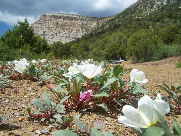 |
|
|
advertisement |
|
|
advertisement |