| |
| |
Douglas Pass
This pass is on the western edge
of the state. It is a gradual but very long climb
to a sage and forest covered plateau. But - unlike
you would expect from this plateau - the road does
not linger long on the flat table top, but quickly
finds the nearest drainage, along which to
descend, West Douglas Creek, It used to be that
even on holiday weekends this pass was far from
the maddening crowd. But during the Memorial Day
weekend of 2017, traffic conditions were less than
pleasant. Otherwise traffic is generally light.
But it is necessary to pack all provisions
between Loma and Rangely.
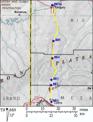
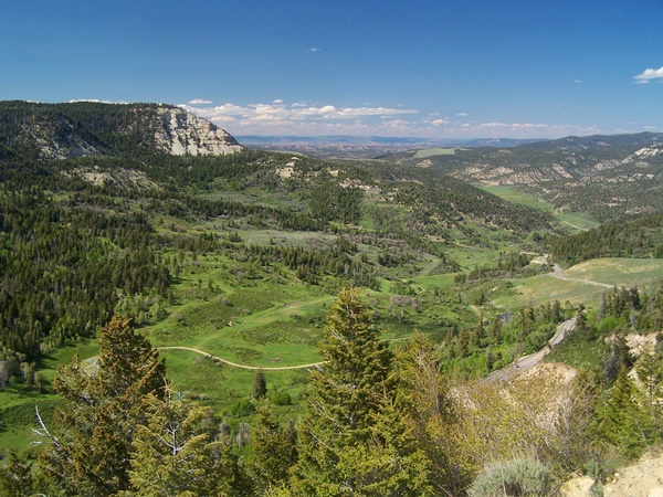
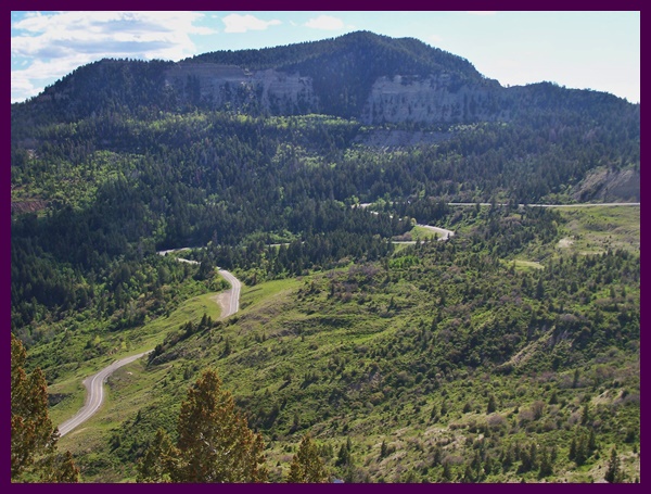
The location and orientation of the pass is unusual for Colorado. This is the westenmost paved pass in the state with a larger north south reach than any other pass in the state. Two dayrides to the top of the pass are on this page, under the heading "the ride to Nowhere". The views area a lot better a short distance above the pass on dirt roads. All pictures were taken from there: Four A Ridge Rd and ZVI Rd. Principal Approaches
From North. This stretch through layer
cake dessert hills must be one of the loneliest
paved cycling climbs in the state, which only
helps to preserve the archeological areas found
along the route. There are a number of examples of
native rock paintings from the Fremont period,
that can be seen in much the same context as
Escalante once did in 1776. A few idiots added
their names, but fewer than the average number of
idiots. Once the road enters plateau country, it follows
East Salt Creek in a relatively straight grassy
valley. After hours of this the switchbacks
approaching the top come as a surprise, unless
exhaustion has eliminated the ability to be
surprised at this point. Approaching the top of
the pass, there are several spur roads, leading to
gas wellheads. Some of the drilling sites are at
vantage points above the valley, that could have
been chosen for their view instead. But, unlike in
other parts of the workd, instead of a medieval
ruin, the visitor is instead greeted by the odor
of natural gas escaping from a wellhead.
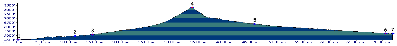
Dayride with this point as shoulder point: An out and back ride from Loma to the top of the
pass and exploring a few miles of tracks near the
top measured 85 miles with 7100ft of climbing,
using a Cateye 100A over 6.5 hours. A Dayride with this point as intermediate
summit is on page: Four A Ridge Rd
s(u) 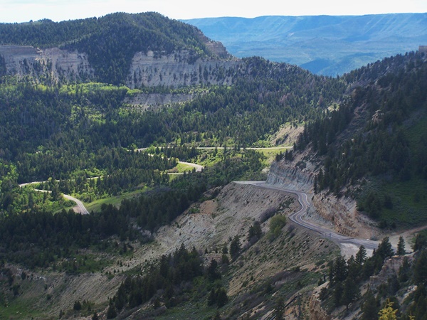
History Escalante (<Alkali - Road Gulch
Divide|Daniel's
Summit(utah)>): The Escalante expedition
entered Colorado in the Hesperus Pass area
near Durango. After having worked their way around
the southern end of Grand Mesa, the fathers
continued to De Beque and up Roan Creek to the top
of Douglas Pass. But today's paved Rte. 139 from
Loma to Douglas Pass doesn't share a single mile
with the Escalante route. The Ute trail they
utilized, penetrated the magnificent cliff edges
of the Roan Plateau far to the east, ascending
Roan Creek from De Beque. On one of the steeper
slopes an accident occurred, where two pack
animals fell and rolled 20 yards. Attempting to
approximate this route on a mountain bike today,
while remaining on public land, would require a
portage to the top of the plateau. On the north side of Douglas Pass, modern Rte.
139 is much closer to the Esclante route and the
old Ute trail. Both descent the Douglas Creek
drainage to the White River through what Escalante
called "Painted Canyon", because of the many
pictograms left by indians. Crossing from the
Colorado at today's De Beque to the White River
took the expedition 4 days. Douglas Pass was the last Colorado pass crossed
by the fathers. The next challenge was the
dessert. After that they crossed an outlying
plateau of the Uintas in Utah over Daniel's Summit
to Utah Lake and returned to New Mexico from
there. Dominguez and Escalante never found what
they were looking for, an easy route for other
California bound Spaniards. They received little
or no credit for their discoveries, large parts of
which would eventually become part of the old
Spanish Trail network. The Escalante story stands in contrast to other
stories of pass exploration. It seems like history
is filled with stories of ambitious lieutenants,
who lead men in frantic searches of nonexistent
rivers. It is also filled with stories of Indian
raids and revenge killings, stories of passes
built by virtual slave labor, except here it's
called capitalism. The Escalante expedition built
a cultural bridge to natives. They described more
and traveled further without weapons and lived to
tell about it, which is quite an accomplishment in
the larger scheme of things. The Escalante
expedition touched upon many scenic perls of the
central western states, the canyons of Dinosaur,
the lakes of Grand Mesa, bits of Mesa Verde and a
hundred others. Modern Highways: Today's road over the pass is a result of mining. But unlike most Colorado mining passes, this in not the story of a frantic rush for shiny precious metals. Gilsonite started to be mined in Vernal (Ut) in 1897. The railhead was on the other side of the pass in Grand Junction, and in addition to the existing transportation route over Baxter Pass, a road was advantageous to get the ore out. The road was named after the Ute chief Douglas, known for his involvement in the Meeker massacre in 1879.
|
||||||||||||||||||||||||||||||||||||||||||||
|
|
advertisement |
|
|
advertisement |