| |
| |
Co78 Wet Mountains s(u) This unpaved forest summit
seems to be created just for a nice,
comfortable gravel day loop ride in the
Wet Mountains. The scenery here is trees.
The spectacle of the Sangre de Cristo
Range is hidden on the other side of Green
Horn Mtn.
From
East. A fast and long decent leads to
the outskirts of Beulah. Along the way the
closest thing to a great mountain view can
be spotted through the trees, in the form of
Greenhorn Mountain, framed by trees.
Approaching Beulah, there are enough turns
and roads to vacation homes to potentially
cause a loss of all sence of direction, and
the residents of Beulah don't seem to think
much of road signs. Sometimes, even in the
age of google maps, you can still find a
friendly resident, to explain nearby road
situation, although it took me several tries
this time. While completing a gravel loop
back to the north, another summit has to be
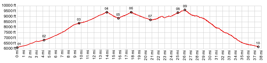
crossed : Northcreek Rd s(u). 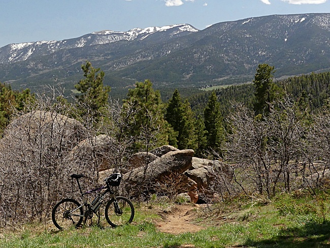 Dayride with this point
as highest summit:
PARTIALLY PAVED / UNPAVED (< Skyline Dr s(u) | Old Raton Pass > ) Co78 Wet Mountains s(u) , Wixson Divide , Bigelow Divide , CR387 Northcreek Rd s(u) : jct Co96 - Smith Creek Forest Rd > up Co96 > upCo165 > Wixson Divide > Bigelow Divide > Co78 east > Co78 Wet Mountains s(u) > South Pine Dr north > Curtis Dr north > Beulah > Central Ave east > CR387 Northcreek Rd north > CR387 Northcreek Rd s(u) > Co96 west back to starting point: 48.0miles with 6300ft of climbing in 5:39hrs (garmin etrex20 m5:21.5.8) |
|
|
advertisement |
|
|
advertisement |