| |
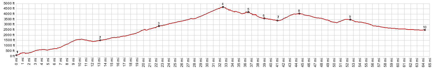
Bennett Pass
This is one of the higher
paved passes in this area, but it's far from
being the most interesting road summit.
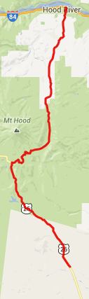
From North. There are a few
far views of Mount Hood after leaving Parkdale.
Then this is a pure workout ride with long,
steady straight aways through the woods without
any change in sight. At the top Mount Hood
suddenly appears again when passing under the
sno-park turnoff. From South. (described
downwards) The frequency of Mount Hood sightings
picks up dramatically as the road rolls along
and then makes a hardly noticeable climb to Barlow Pass.
To me the most interesting sight along the way
is crossing the wildly braided "Green Apple
Creek" on a bridge between Barlow Pass and
Bennett Pass. The road drops further to its
junction with Or35. The road visible far above
on this last section is Or173
climbing to government camp. At this point
I was so scenically starved even road number
signs started to look good (see picture on that
page). The profile continues to a low point
before the road ascends Wapinita Pass again.
PARTIALLY PAVED / UNPAVED ( < Timberline
Lodge: Mount Hood s(u) | Barlow Pass
> ) -
|
 Approaches
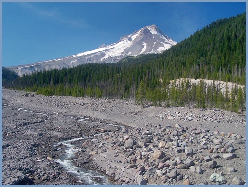
|
|
advertisement |
|
|
advertisement |