|
-
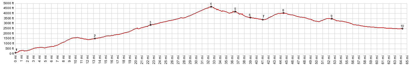
01.(100ft,mile00.0)START-END NORTH: Hood River
02.(1550ft,mile13.3)jct with Or281 to Parkdale on left
03.(2900ft,mile22.5)Cooper Spur Rd joins from right
04.(4670ft,mile32.6)TOP: Bennett Pass
05.(4220ft,mile36.7)Barlow Pass is located immediately left of this turnoff
06.(3630ft,mile38.9)jct with US26 to Government Camp on right
07.(3440ft,mile41.1)intermediate low point
08.(4100ft,mile44.4)highest point in Blue Pass area
09.(3520ft,mile52.6)jct with Or216 on left
10.(2570ft,mile64.2)START-END EAST:US26 low point before US26 crosses Warm Springs River
View Or_bennett_pass in a larger map |
-