| |
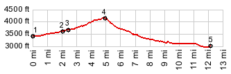
 Barlow Pass Barlow Pass Coming down US35 from Bennett
Pass to the north, Barlow Pass is just a
shoulder point. But this pass can still be the
highest point on a mountain bike ride, and
this one is more interesting than busy US35,
at least in the summer months, when traffic is
heaviest.
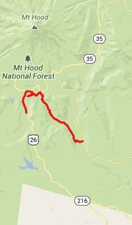
Approaches From West. This side
is completely paved. Shortly after Or35 branches
off US26, and takes a good deal of the traffic
with it to Government Camp, a small paved road
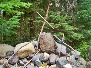
also branches to the right, signed "Pioneer
Woman Grave". The grave stop appears after a few
hundred yards. It is a recreated pile of stones
and crosses tied with twigs, commemorating an
Oregon Trail Emigrant and his wife, whom he
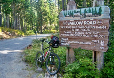
buried here. This overgrown old highway through
the weeds continues all the way to the top of
the old Barlow Pass. It is just a few hundred
feet away from the US26 spot with the same name,
and virtually at the identical elevation. The
"Oregon Scenic Trail" crosses here. It is closed
to bicycles, but not so the continuation of the
Barlow Road, here also the Oregon Trail,
branching off down to the right. During my visit
it was closed due to a failing bridge, but
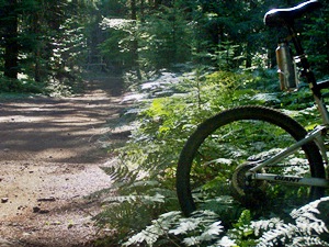
getting a bicycle over it was no problem.  From East. (described
downwards). A very rough dirt road, initially
leads steeply downhill in order to cross the
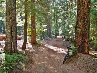
aforementioned creek. The road continues through
dense forest, with large trees trunks exactly
defining the slightly meandering path of the
road. The road passes three campgrounds before
crossing paved FR48. With each campground the
road gets easier to negotiate. At the third
campground, named Barlow Crossing (yes, there is
another bridge here), road conditions have
normalized to such a degree, that there is
nothing to keep away the camping Mc Mansions. My
own route continued on FR43, which is a wide
paved road free of traffic. But the profile
continues on the Barlow Road, also signed FR3530 Dayride: PARTIALLY PAVED / UNPAVED ( < Bennett Pass
| Seven
Mile Hill Road s(u) > )
-
|
|
|
advertisement |
|
|
advertisement |