| |
| |
MacDonald Pass I want to call this one
Stinking-Car-Exhaust Pass. It is 4 lanes of
asphalt all the way, and barely a turn to
keep down the noise level or the exhaust
fumes. But maybe during conditions other
than a cloudless blazing August heat wave,
conditions are better than that. Actually I
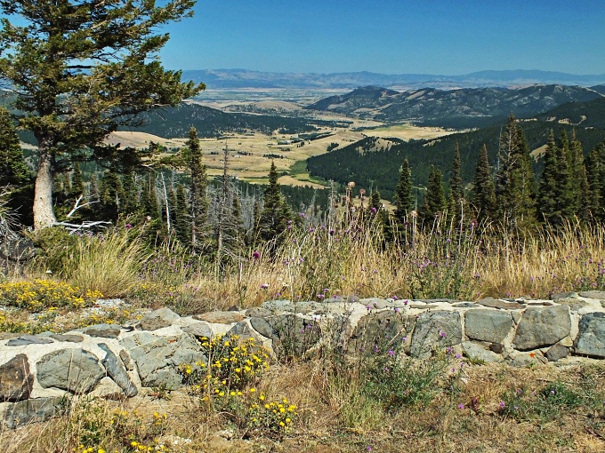
am sure they must be. There are two fairly
nice views along the way of the Helena
Valley. And - except for a short section
below the summit on the east side, there are
no rumble strips, or there is a spacious
shoulder - something that is really rare in
western Montana.
From
West (described downwards). If it
wasn't for the fact that the bike moves down
the road without any necessary pedaling,
scenery-wise this could be a few foothills
in the Appalachians. A short distance down
the road is a roadside water spigot,
originating from a wonderfully cold spring.
A roadside sign anounces it 1/4 mile prior
to getting there. Mandatory pedaling resumes
at the junction with Mullan Pass Rd
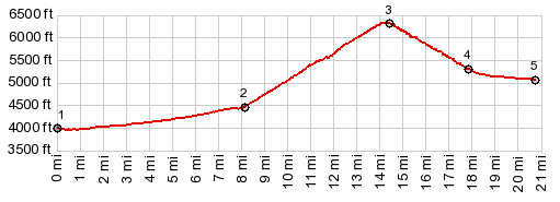
Darrides with this point
as highest summit:
PARTIALLY PAVED / UNPAVED ( < Marias Pass | same page> ) MacDonald Pass , Mullan Pass , additional out and back : near jct US12 - Mullan Pass Rd > up Mullan Pass Rd > Mullan Pass > down Skelly Gulch Rd > Birdseye > jct with US12 <> out and back into Helena > US12 west > MacDonald Pass > US12 west > back to startingpoint near jct US12 - Mullan Pass Rd: 50.3miles with3710ft of climbing in 4:55hrs (garmin etrex30 m3:20.8.15) Notes: last very hot day before the start of a "real "heat wave. (<same page | Stemple Pass > ) MacDonald Pass, Priest Pass: near jct US12 - Mullan Pass Rd > up Mullan Pass Rd > jct with FR335 <> out and back up Mullan Pass Rd to turnaround point at next railroad crossing >> up FR335 > Priest Pass > down east side of FR345 > US12 west > MacDonald Pass <> a few miles of exparatory out and back at summit >> US12 west > back to starting point near jct US12 - Mullan Rd: 26.9miles with 3010ft of climbing in 3:03hrs (garmin etrex30 m3:20.8.16) Notes: miniature morning ride during major heat wave, with temperatures forecast in the 100s in some areas of the YPR listening area. -still definitely cooler at the next camping spot on the top of Mac Donald Pass. The planned route had been to ride to the top of Mullan Pass and then take the Continental Divide Trail to Mac Donald Pass. But a BNSF trail blocked a road crossing for indeterminate time, I decided for Priest Pass instead. I think this was actually a more enjoyable route than the CD trail. 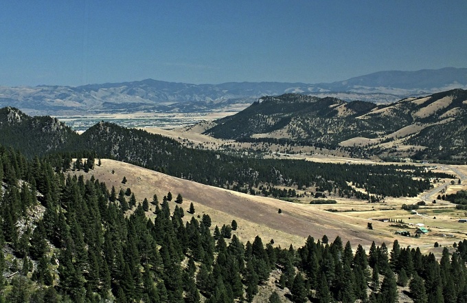 History Toll Roads: Aproximatel two decades after Mullan had opened his nearby military road of the pass by the same name, and 5 years before railroads would start to run over Mullan Pass, conditions were right for a toll road to be built over this nearby summit. According to Sprague's "the great Gates", it was built by EM Lige Dumphy in the 1870s and managed by MacDonald who has his name attached to it until 1876. A sign at the summit suggests another name for the pass "French Woman's Pass", after the wife of the builder, who ran a popular Inn at its base on the west side in Elliston. She was murdered without that the case ever being solved, but her husband considered the prime subject. 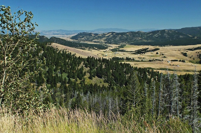 |
|
|
advertisement |
|
|
advertisement |