| |
| |
FR500 Oakley - Rogerson
Rd(sh)
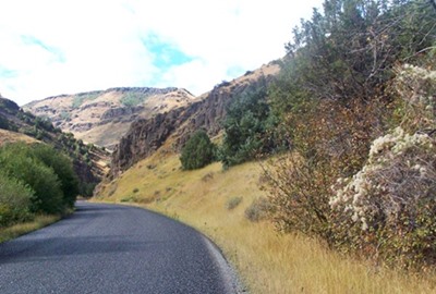
Of what I know of the Twin Falls
area sofar ... the nicest paved climb in
this area is a ride up Rock Creek Rd to the laid
back Magic Mountain ski area. On a road bike this
is an out and back ride. But not restricting
yourself to paved roads, with a mountain bike, you
can construct virtually endless loops, utilizing
this canyon road as part of the loop. This
particular one reaches a summit on a good, unpaved
backroad connecting the small towns Oakley and
Rogerson.
As the road traverses the ski area, unpaved FR500
diverts on the right, and doubles back to the
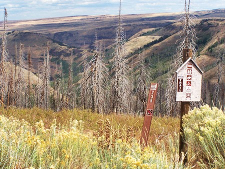
north. There are several trailheads here. After
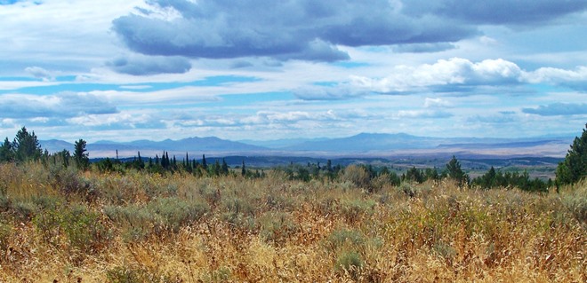
several switchbacks the road reaches a summit with
far reaching views to gentle distant ridges to the
south. The view also includes a higher mountain
with another ski area to the east (Pomerelle), and
countless linear rock lips stretching in low
canyons to the Snake River Plain to the north. The
road is in great shape for fast progress without
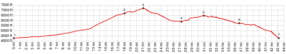
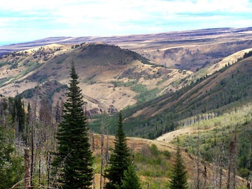
any washboard From North-2. (described downwards). Progress is lightning fast, with just enough slope to let the bike roll at full speed through only a few turns. The scenery here is just fairly nondescript low hills. My own route turned off at FR513 to the Bear Gulch campground, and the profile continues over the route I happened to take, over a second summit point: FR544 Indian Springs Rd(sh).
PARTIALLY PAVED / UNPAVED ( < Mores Creek Summit | Pike Mountain s(u) > ) FR500 Oakley - Rogerson Rd(sh) , FR544 Indian Springs Rd(sh) : entrance to canyon on Id-G3 Rock Creek Rd > up Id-G3 Rock Creek Rd > Magic Mtn ski area > FR500 Oakley - Rogerson Rd west > FR513 north > Bear Gulch campground > TR848 north > FR544 north > FR544 Indian Springs Rd(sh) > at unsigned fork the eastern option directly back down to Id-G3 Rock Creek Rd > Rock Creek Rd north back to starting point: 45.5miles with 4400ft of climbing in 4:52hrs (garmin etrex30 m5:17.9.20).
|
|
|
advertisement |
|
|
advertisement |