| |
|
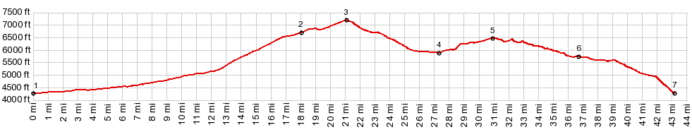
1.(00.0m,4260ft)START-END NORTH-1: jct Rock Creek Rd - Cherry Creek Rd
2.(18.0m,6710ft)profile turns right onto FR500
3.(21.1m,7170ft)TOP: FR500 Oakley - Rogerson Rd(sh)
4.(27.4m,5400ft)profile turns right onto FR513
5.(31.0m,6440ft)TOP: FR544 Indian Springs Rd
6.(36.8m,5740ft)profile stays right on Indian Springs Rd
7.(43.2m,4260ft)START-END NORTH-2
|