| |
| |
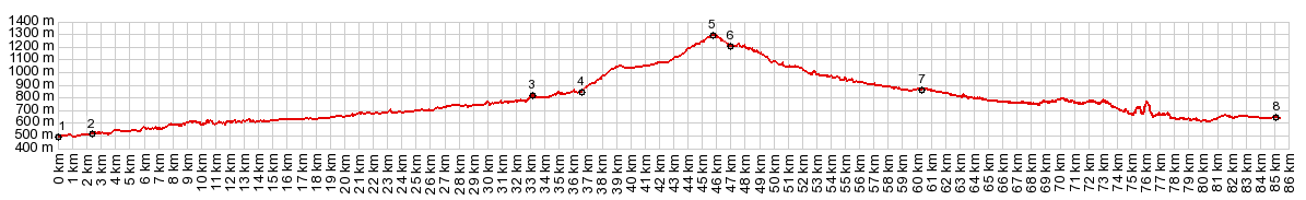
Alto de Zuriza s(u)
This is one of several isolated,
western Pyrenean foothill passes, that run
parallel to the main ridge. They can be strung
together in a day ride. The main attraction of
this one is the rugged limestone canyon on the
east side, and the equally rugged, narrow road.
The real top is forested, but framed by trees
with a nice view of high peaks to the west. I meet
two mountain bikers here and we took youies of
each other. That once was a popular practice
before selfies exceeded them in popularity by a
large margin; ... you know... you ask sombody
nearby to take a picture of you with the scenery,
and do the same for them. From East. (described
downwards) The profile does not continue to the
place named Zuriza, which is really just a single
lodge. Instead it takes a sharp right into the
imposing entrance gates limestone canyon.
The best of the scenery starts now. This becomes
apparent in the first moments of the descent. This
road is very narrow and calling it paved is
sometimes an overstatement. There is very little
time to watch the road below when there is so much
to see above. Traffic can be quite a problem - not cars - I
don't remember seeing any, but just like in one of
the pictures in the slide show, I get caught in a
huge flock of sheep. The sheep-dog looks just like
the one in the picture, but I have to assume it's
a different one. The road remains at the very
bottom of the canyon, so that no special civil
engineering efforts are required, outside of a
small bridge or a small dirt parking lot to let
cars pass in opposite direction. I take the most
interesting pictures where the road extracts
itself from the narrow limestone walls, a place to
gain some perspective on what is above, instead of
being caught in this crevasse. Also the light
conditions improve with the downslope winds from
the high Pyrenees. I am wondering if one or two of
the pictures in the slideshow could have been take
a little higher up, on the side of the canyon. But
whatever light you get here plays the most
important part in the visual story of this ride.
Anso seems like it could be a pleasant tourist
town. When I am there the cobbled streets and
their natural stone buildings are deserted. I am
the only costumer in the small grocery store and
all I want is more bread for my still ample supply
of salami. The town drapes over a long low ridge
on the other side of the Rio Veral and make an
interesting spectacle as the entire elongated town
moves by the bicycle, rolling along at a
convenient viewing height . All this makes it more
interesting than just a "pleasant tourist town". Below Anso the road becomes much wider and
smoother - you could say it becomes just another
regular run of the mill road. Only about three km
below Hecho my route turns west over another low
Pyrenean foothills pass, that parallels the
main ridge, and it just cries out to be compared
to this one: Alto de
Hecho (someteimes spelled without the H).
But the profile continues back down into the
valley and ends in the town of Bergun. I did not
include any pictures of Bergun. But it would
deserve its own slide show. It sits on top of a
mesa near the middle of the valley. It is hard to
imagine a better strategic position. A Day on a Tour with this point as highest summit: COMPLETELY PAVED: ( < Port de Larrau | Puerto de Cotefablo > ) Alto de Zuriza , Alto de Aisa , Alto Hecho : Isaba > Alto de Zuriza > Anso > Alto Hecho > Hecho with sightseeing detour > Jasa > Alto de Aisa > Aisa > down A2605 > Jaca with shopping and hostal search detours. Notes: gps data is on stolen computer A Dayride with this point as highest summit: (<Monastario San Juan de la Pena s(u) | >> Alto de Zuriza , A176 Anso - Garde s(u) : Anso > A176 Anso - Garde s(u) > Garde > Isaba with sightseeing detour > Alto de Zuriza <> out and back to Zuriza << refugio de Linsa > down carretera Zuriza - Linsa > back to starting point in Anso with sightseeing detour: 44.6miles with 4390ft of climbing in4:49hrs (garmin etrex r5:22.10.20) Notes: including a loop hike over a low round mountain from Linsa b+h: 47.9miles with 5320ft of climbing in 6:19hrs |

|
|
advertisement |
|
|
advertisement |