| |
| |
Col De Perret
This low foothill pass east of
Geneva connects the Vallee Verte with another
parallel valley to the east. For me this was a
great way to connect interesting villages, while
the weather on the higher roads was too wet.
From South. (described
downwards). A gentle descent leads past a busy
village or two. I'm not sure if you can see high
peaks during the descent. In my case I saw clouds
at every elevation. This side has a more uniform
approach. It leads into a large
conglomeration of busy valley towns with all their
traffic and businesses, taking advantage of the
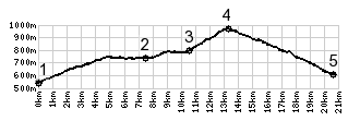
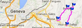
easy access in front of the "real mountains". 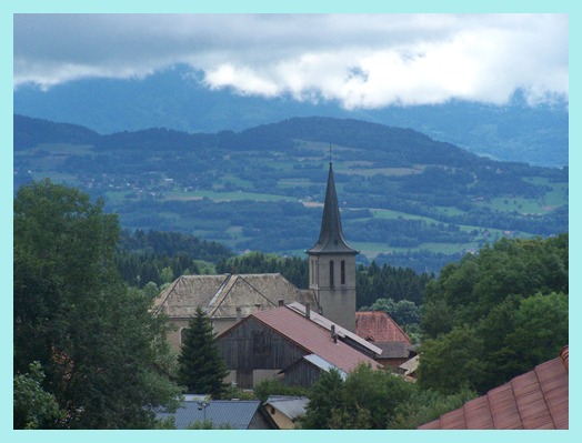 Dayride with this point as
highest summit: Dayride with this point as
highest summit:Col Du Perret , Col de Saxel : Annemasse > Saint Gergues > Route des Charaigniers > Col de Saxel > Saxel > Booge > Col Du Perret > Bogeve > back to starting point in Annemasse with detours: 38.9miles with 2900ft of climbing in 3:46hrs (Garmin etrex 30: 14.7.14) the last day with different start and end points on this tour is on page: Mont Saleve northern summit
|
|
|
advertisement |
|
|
advertisement |