|
|||||||||||||||||
|
|
|||||||||||||||||
| |
|
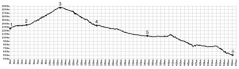
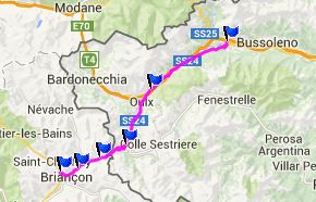
Col de Montgenevre
Col de Montgenevre is a busy main road between Briancon in
France and the Susa Valey in Italy. Compared with other options
to the north and south, this is a lower and more direct
crossing, and the result is quite a bit of traffic on an often
small, curvy road. A little longer option, to avoid the traffic
is a detour over Col de l'Echelle
to the north. Or ride both of them in a day long loop, and you
get to see what Romans saw on their highway in the 2nd century
BC - more or less, mostly less. The top looks completely
different today. The pass is located in the dense commerce of a
ski town.
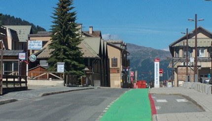
Now the road turns straight westwards and quickly crests in
the middle of the ski town Montgenevre. The main road goes
through a short tunnel under the main business district. But the
bike path crests under the Col de Montgenevre sign in between
hotels and ski stores. The ski slopes have a manicured lawn look
in summer. No wonder - now people drive golf carts around, so
that they can knock little balls into holes on steep slopes.
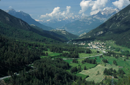
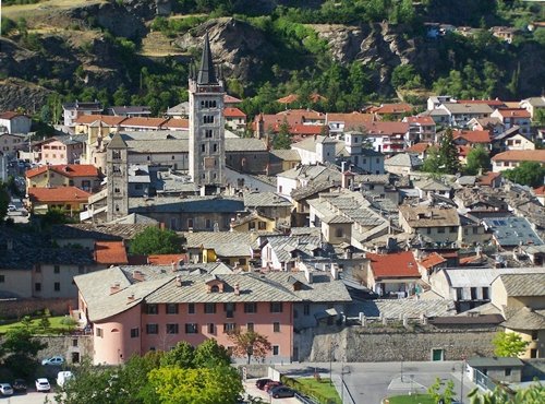
In Cesana Torinese the traffic from another ski town pass, Col
du Sestriere merges. Now a wide, busy main road leads
downvalley into Susa. Highpoints for me are the views of the
fort in Exilles, then the interplay of the road we are on with
the autostrada, sometimes up on stilts, sometimes above, other
times separated by an old bridge that now carries nothing but
weeds. The swinging turns down into Susa are also fun and seem
to celebrate the grandeur of the valley, which now merges with
the Col du Mont Cenis traffic. Historical Notes: Napoleon: During the mid 18th century French and English engineers started to build roads that were a great improvement on the engineering of the Romans. Grades were kept lower, the surface became harder and more even, and rest houses were built. Napoleon took advantage of this and improved many pass roads, amongst them the pass over Montgenenevre. Cycling - Tour de France: The pass was 10 times on the
route on 9 years: 1949, 52, 56, 66, 92, 96, 99, 2011. In 1996
the pass was on the route during two consecutive stages. Dayride with this point as highest summit: The last day over a pass with different start and end points on this tour is Passo de Gavia
|
|
|
advertisement |
|
|
advertisement |