| |
| |
Col de Sestriere
Col de Sestriere is not marked on
many roadmaps. Maybe it felt redundant to put the
name "Col de Sestriere" exactly next to the town
name Sestriere. This pass is located in the town
center of the olympic skiing resort for the year
2006. The wide roads and the elaborate ritzy
infrastructure, needed for the olypics are also
very useful for a large bike race, and so the Tour
de France and the Giro d'Italia finished many
stages up here
If money travels, it needs wide roads, and Sestriere delivers. This makes the whole ride very relaxing, looking at all these well kept villages with massive stone walls, with construction cranes pulling up new structures. The road passes a ski jumping arena. Past Pragelato a single large switchback delivers the first view of a white wall as background to the well kept country side. Soon the plot of the road becomes clear. A ski lift descends in a straight line from the highest ridge ahead, apparently intersecting with a power line heading uphill. The latter breathes life into the resort. Actually the powerline crosses a little above the
town. But a solid wall of condo towers marks the
spot ahead, where one might otherwise expect the
decaying walls of a WW1 fortification or a
picturesque church tower, that threatens to
collapse, if it were not for skiing scene. But Sestriere is still an amazingly interesting
and different cycling summit. Entering town, you
first ride along a fabricated set of row houses
like in a factory town, but in this case housing
every kind of business, where a skier might spend
money. In June it has a pleasant ghost town look.
Even in the town center - the commercial heart of
the town, just a block above the pass, only a
single person is reading a newspaper, completely
oblivious to anything that might be going on
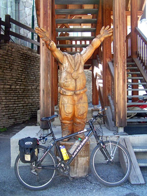
around him - like me taking a photo of my bicycle
in front of the statue of a headless olympics
medalist. This sculpture is an actual artistic
statement, very capable of igniting argument and
controversy, something that would be unimaginable
in another ski resort - Vail for example, much
closer to where I love. 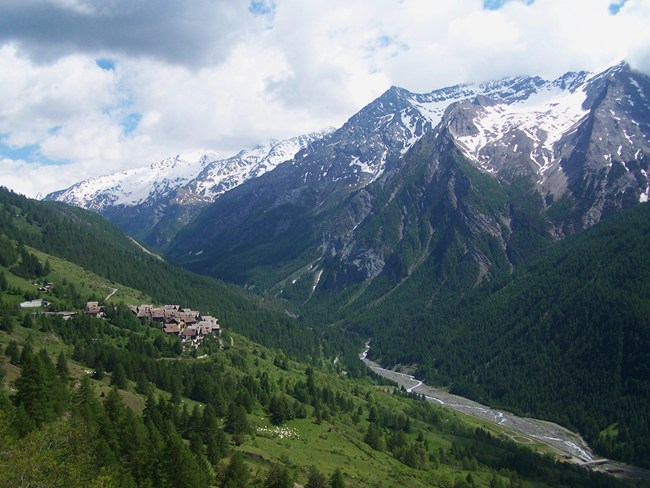
From North. (described
downwards) The exact highest point of the pass is
just below the turnoff to the "main square", or
octagon. But the most unusual buildings are a
short distance to the north. Two hotels appear to
be housed in, what looks like the conversion of an
old water tower from the industrial revolution
into modern "loft space". Of course here they
first had to build the "old water tower from the
industrial revolution". - More details on this
innovative architecture below in the history
section. There are a few route variations possible on this side. I took the main road. Soon the bike rolls on its own again, and the lympically inspired foreground disappears in favor of a sinusoidally winding roads, snowcapped walls reaching to over 3000m on the French Italian border, and also a few picturesque little villages without water towers. The descend has hardly any switchbacks. One can just let it roll. Before entering the attractive looking town of Claviere, you can see the enormously long gallery, burrowing its way down from Col Montgenevre under a massive block of a mountain. The next section down to Susa serves as lower approach for Col de Sestiere and Col Montgenevre. The road now stays in the valley, but has a few more surprises in store. There is a short climb before Exiles, followed by the biggest WW1 fort in existence - Exiles itself. The road stays just above the village. The houses nestle at the feet of a massive ramp up to the fort. The view from the road is at the level of the stone roofs. It is like surveying an imaginary landscape of slanted rock plains. While the railroad on the other side of the steep
valley traverses along the forest, the main
traffic carrier - the expressway goes up on
stilts. Foreshortened at one point it has a
futuristic on-stilts look. Finally a last long
winding descend leads into Susa. But the profile
continues all the way back to Milano.
The name Sestriere comes from a stone, that the
Romans used to mark their roads. It was the 6th
stone placed equidistantly from Turino. The Valle
de Chisone remained the main traffic artery
towards France until the 1980s. Then the opening
of the Mt Cenis Tunnel. shifted traffic into the
Susa Valley. Cycling. The summit plays an important
role in the world's two most popular bike races,
the Giro d'Italia and the Tour de France. Being so
close to the French border, the French Tour always
climbed the pass from its home direction, the
west, while the Giro crossed it in all conceivable
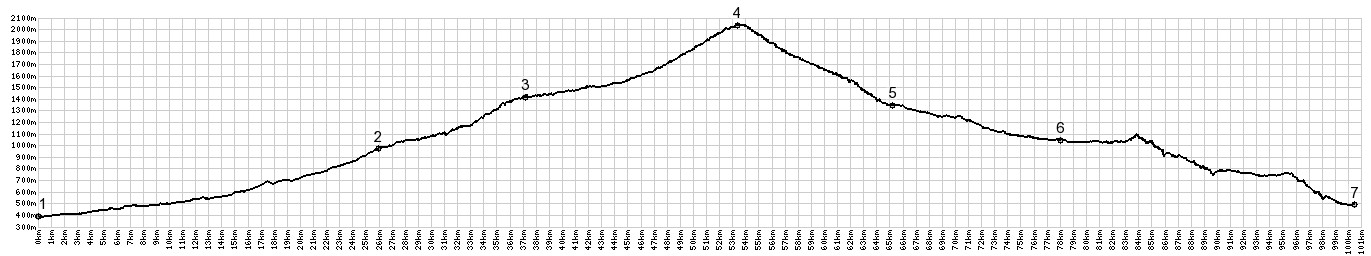
directions. A Dayride with this point as intermediate
summit is on page: Col delle Finestre 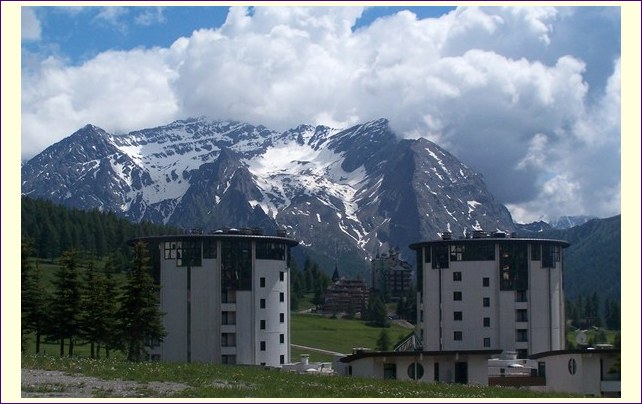
|
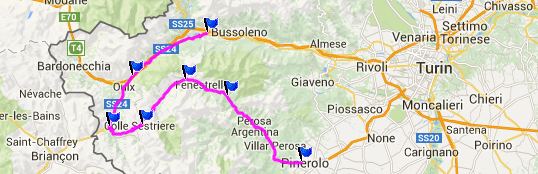
 Approaches
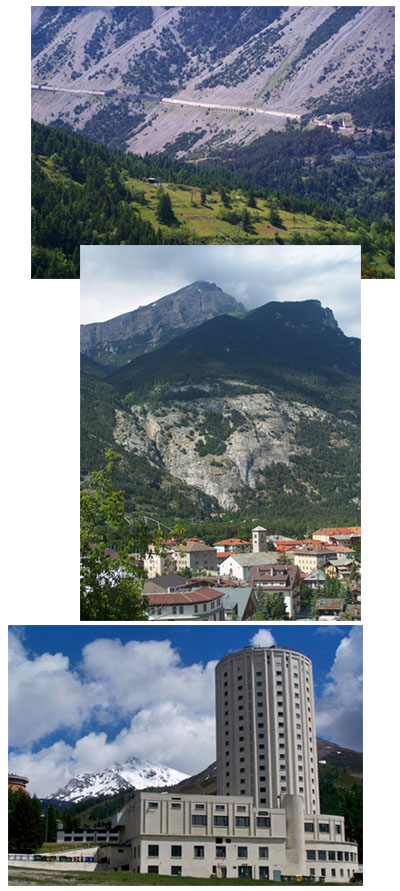 History
|
|
advertisement |
|
|
advertisement |