| |
| |
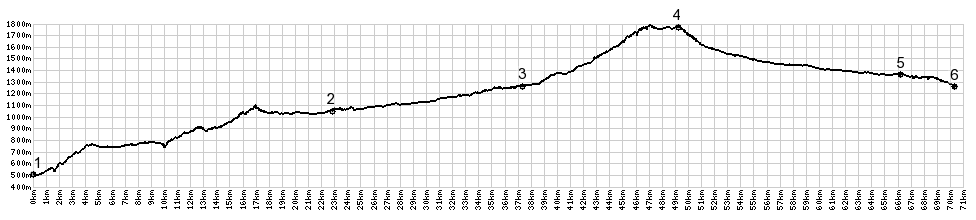
Col de l'Echelle s(u) This pass is an attractive alternative to the high traffic route over Col de Montgenevre, between Italy and France. Or you can brave the traffic and construct a day loop over both of them. Considering the fact, that this is the lowest pass crossing between the two countries in the western alps, it is surprising that this is a remote low traffic route. Apparently it has none of the historic significance of nearby Col de Montgenevre. But on a bike, this is clearly the better route.
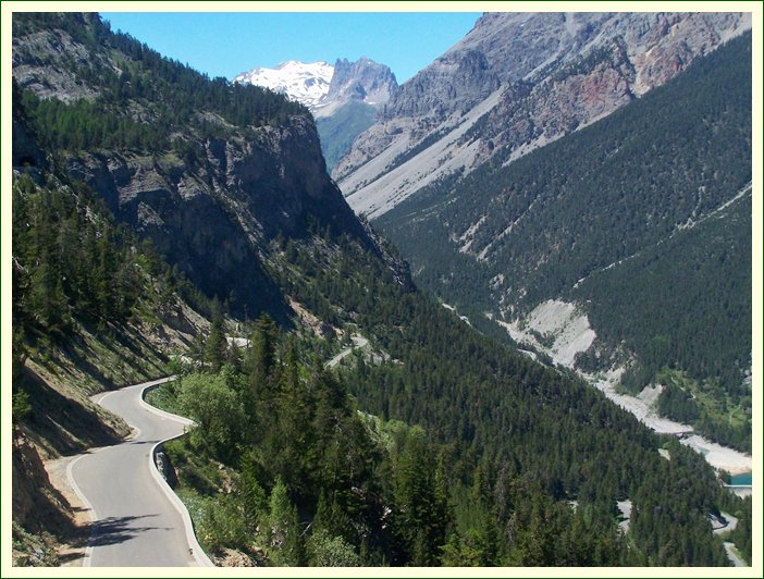
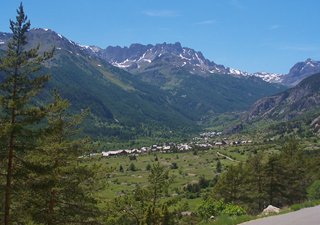
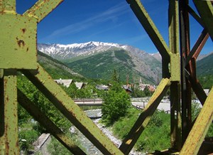
Bardonecchia seems to have a lot of bicycle traffic. Also apparent - many buildings featuring non rectangular architecture - very modern looking in a hip sort of way. Somehow it makes a very innovative first impression. After leaving Melezet on a rusty old one way metal bridge, that can be used nicely to frame photos, the scheme of this road becomes quickly clear. A few zig zag road cuts become visible, somewhere up there, between the valley and those tea kettle shaped peaks above. The road crosses into France, and soon you are on the first zig. The best views on this ride are (during the particular light conditions that I had) up the "Right Hand Fork" as this valley is called. It has a keyhole like mountain standing watch past its entrance. But gazing down at Bardonechia, cows grazing in front of town town like specks of dust, the view of 3350m Pta Sommeiller behind is almost as good. There is a one way bike route up to a pass in that area. The Col de l'Echelle road enters a quick
succession of two short tunnels, with an
adventurous perch separating them, and quickly
crests at a sign saying "Col de l'Eche. Something
must have happened to the "lle". But as it turns
out, the pass itself is a little lower than the
actual summit point, which comes a little later.
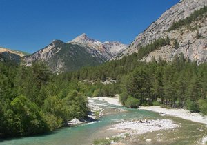
From West. The road now
rolls along a fairly narrow high valley, with
alpine grasses filling the space between the
loosely spaced needle trees - a very park like
scenery. A gently winding descent through
the trees leads to a grassy valley. In Saint
Hypolite, another mountain spur joins in, to
continue downvalley along every curve of the
river. The gentle roll down the Valle de Pres,
requires pedaling downhill. Val des Pres is the
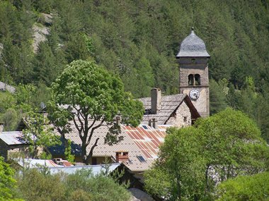
last quiet town, clustered around a solid church
steeple before the main road to Briancon. The last
few km on the profile are in common with the high
traffic approach to Col de Montgenevre. A Dayride with this point as intermediate summit is on page Col De Montgenevre
^ bottom left:
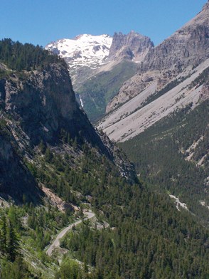
Ruisseau de la Valee Edroite on the eastern
approach V - a one way
bike route also goes up to a pass on the left of
the summit of Monte Someiller (~3300m), seen
straight ahead at the back of the valley behind
the villagage Bardonecchia 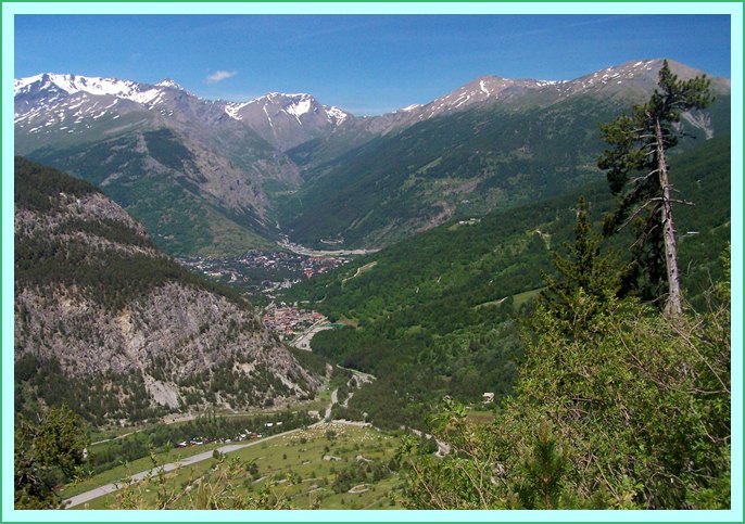 |
|
|
advertisement |
|
|
advertisement |