| |
|
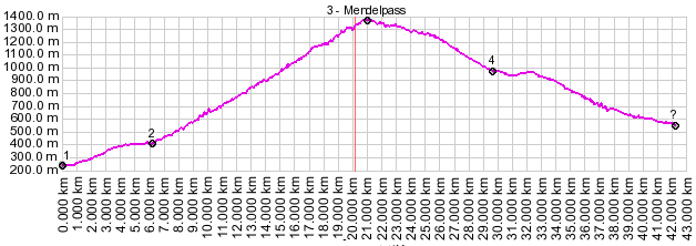
01.(00.0km,241m) START-END EAST: jct SS42 Bozner Strasse - Weinstrasse bike path at railroad station in Appiano
02.(6.1km,415m) route turns uphill away from SP14
03.(20.8km,1363m) TOP: Mendelpass
04.(28.7km,1014m) route joins with Via Roma (route from Gampenpass) on right
05.(41.8km,561m) START-END WEST: Demulo
|
|