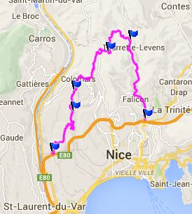
D719 Aspremont (sh)
The east side of the river Var, immediately north of Nice
has just about the worst traffic and urban sprawl in the
city. Climbing the ridge to the west to this summit is an
alternative. It is a more interesting ride and it will also
take a lot longer.
 |
1.(50m,00.0km)START-END
WEST:route starts climbing D719 or Chemin de Cremat
2.(280m,07.0km)Route de Bellet/Boulvard de Madeleine
joins from right
3.(310m,08.9km)another Corniche joins from the Var
Valley on left
4.(530m,15.9km)TOP: D719 Aspremont(sh), a short
distance past Aspremont
5.(360m,20.2km)START-END EAST ALT: Tourette-Levens:
jct with road to Col Chateauneuf
6.(60m,28.0km)START-END EAST: M19 in Saint Andre De La
Roche
|
Approaches
From West. A GPS was useful for finding
the initial part of this climb. All remotely traffic unclogged
sideroads seem to terminate at gigantic construction project,
that looks like an oversized deflated, fraying tire. My map says
it's supposed to be a Le Clerc business complex. But to the west
a small road labeled Chemin de Cremat starts to climb the ridge
to the west with determination.
A maze of intersections to houses in the hills follows. But
actually, given that there are so many structures up here, it is
surprising that the traffic here is fairly light, and the road
does its best to keep it no faster than a bicycle by providing
millions of turns. I just followed sings for Aspremont and when
in doubt choose the uphill option. It worked for me, and finally
I arrived at this little hilltown, just in time for the local
fruit market next to the road. There are not only great views of
the various human construction projects, lining the glacial
deposits of the Var, but also great views of the snow cloaked
ridge line to the north.
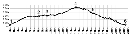
The road reaches its summit after Aspremont, where it crosses
a saddle over to the viewshed to Tourette Levens. It looks like
small secondary roads to the north reach 50m or so higher
elevation. So I'll call D719 a shoulder summit.
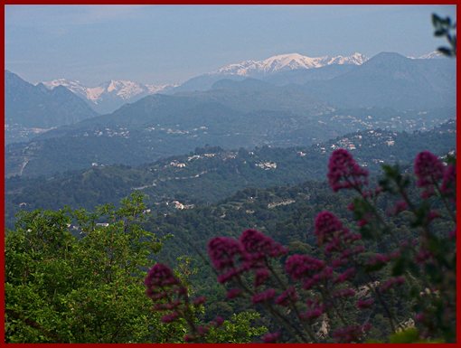
From East. A quick descend goes to
M19, accompanied by great views of Tourette-Levens and its
crowning church tower. M19 is a lot busier and traffic less
friendly than on the route described sofar. But one doesn't have
to put up with it for very long, if you also go over another
summit. That option involves going up M19 to the next traffic
circle and then turning right to climb Col
de Chateauneuf. The profile does not do this, but instead
takes M19 down to Nice, to show a direct climb with maximum
elevation gain.
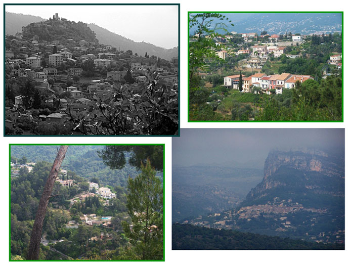
A Dayride with this point as intermediate summit is
on page: Chemin de la
Greo: Berre les Alps s(u)

|