| |
| |
Col de la Croix Fry
The best part of
this pass, in my opinion, is the eastern approach.
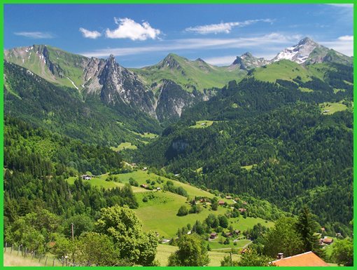
It is a veritable viewing platform onto the Chaine
des Aravis and its villages, for mile upon mile.
Otherwise, There is very little feeling of
striking out into the wilds of nature on a ride
across this pass. The top is a large town with a
wide main street and all sorts of businesses.
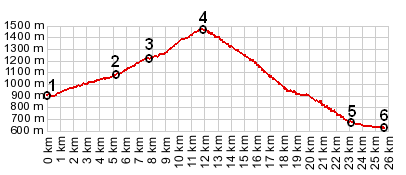
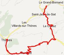
From West. The profile
starts in La Clusaz, where a smaller road
parallels D909 to Col
de Aravis. A popular loop ride over several
passes goes over Col de Aravis, then descending a
short distance to les Etages, before climbing to
Col de Croix Fry again. Having made that turnoff,
there is much less traffic than on the Col de
Aravis. Now there is time to relax, climbing
moderately through the forest. The Chaine de
Aravis looms above to the left. The top of this
pass is signed and also the start of a fairly
large town by the same name, consisting of tourist
and ski businesses. From East. (described
downwards). All the scenic excitement of this pass
happens on this side. The reason for this is that
the road descends on a ridge, that makes the
perfect viewing balcony of the Aravis Chain and
the various villages glued to its hillsides. Cows
with loud bells make the musical background.
Manigod is a flower bespeckled village of
buildings, that could accomodate oversized people
in its oversized houses, while the church bell
plays an especially loud tune. The road reaches
the deep valley of the Chamford in Montisbrand and
continues downvalley towards the right to Thones.
History-Cycling: This pass is a fairly recent addition to the Tour de France route. Between the post WW2 years and 2012 it was used in 1994, 1997 and 2004
A Dayride with this page as intermediate summit is on the page: Col des Saises The last pass ride with
different start and end points on this Extended Tour
was: Cormet de
Roselend
|
 Approaches
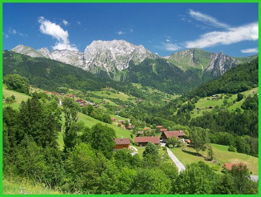
|
|
advertisement |
|
|
advertisement |