| |
| |
Col de Bleine I think this
is one of the nicer passes in this area of
many nice small to medium sized passes. It
is reasonable to think of the Clue de
Greolieres as part of the southern approach
and the Clue Auban as the lowest part of the
western approach. These two gorges may well
be considered the most scenic part of a ride
over the pass. But you can also ride loops
through these canyons without going over the
pass. The Clue
der Greolieres shoulder summit has its
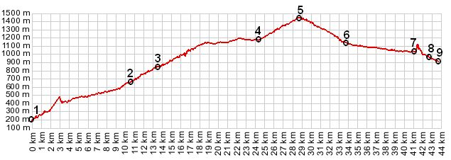
own page. The pictures on this page were
taken on approaches close to Col de Bleine
summit, located beween points 4 and 6.
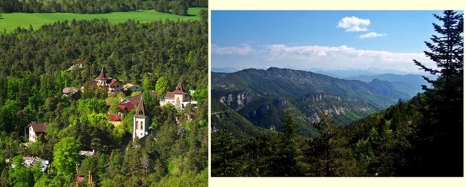
 Approaches From North. The
description starts at point 3. The
Clue de Greolieres climbs above the town of
the same name, passing 3 tunnels, including
one that looks like a natural double arch. It
crests on a forested plateau. The intersection
with Col de Bleine and Col
Castellaras is signed as part of the
"bucles d'Azure" bicycle route. Col de Bleine
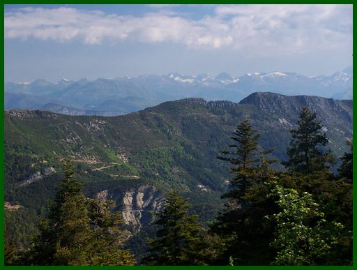
itself is forested on top. But there is a
really good view reaching to the "Mercantour
Park" part of the alps just north of the
summit.
Dayride
Col de Bleine , Col Castellaras , Col de Cornille , Col Bas : Greolieres > up Clue de Greolieres > D2 east > Col de Bleine > St-Auban <> out and back to end of clue de St Auban >> Lattes > (col deLattes?) > Valderoure > Col Bas > Andon >> closed loop over Col de Cornille > Gaille > Andon >> Col Castellaras > down Clue de Greolieres > sp The last sumit point with different start and end points on this Extended Tour is: D2 Clues de Greolieres - Plan du Peyron(sh) back
to Cycling Passes in Europe |
|
|
advertisement |
|
|
advertisement |