| |
| |
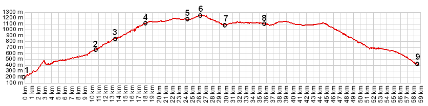
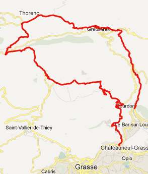
Col Castellaras
In the land of many
small, attractive passes, this one can be easily
combined with many others. The profile is just one
possibility to approach this point from near the
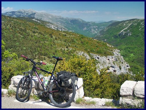
coast. The picture is taken at the summit.
From East. The description
starts at point 3. The town of Greolieres is just
far enough from the coast to keep the crowds away.
I can't say I missed them, even though the few
merchants and restaurants might. The road
traverses up the Montagne de Chevron ridge,
passing through a few short tunnels. Pictures for
that section are on the D2 Clue de
Greolieres/ Plan du Peyron (sh) page. Once
on top of the plateau a left leads to the top of
the pass. From West. (also described
upwards, starting at point 7) As you leave D79,
you leave the alternate valley route below. It
comes in and out of view as you climb to the pass.
The summit is located on the shoulder of a
mountain, where the viewshed changes completely to
the Clue de Greolieres. A Dayride with this pass as
intermediate summit is on page: Col de Bleine
The last summit point with different start and end points on this Extended Tour is: D2 Clues de Greolieres - Plan du Peyron(sh)
back to
Cycling Passes in Europe |
|
|
advertisement |
|
|
advertisement |