| |
| |
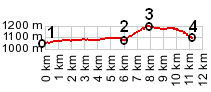
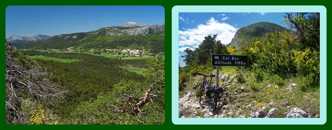
Col Bas
This pass is about
as small as they come. When connecting this summit
to points at sealevel on the coast, using paved
roads only, the route must go over higher or
nearly as high points. Consequently the profile is
tiny, compared to other coastal summits.
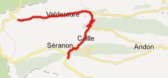
From South. Just to show,
that it really is fairly difficult to make this
climb any bigger, the profile starts on a low spot
on D211. East of Valderroure ( no stores, no park,
not even a picnic/park bench ). Soon a "Boucles
d'Azure" bicycle route sign points up to the
right. There is a nice view of the valley from one
of the few switchbacks (left picture below) From North. (described
downwards) The descent is even smaller. Caille
lies stretched out in a thin line below a
triangular mountain, like a finger reaching out
into the verdant green valley. Here too, I
couldn't find any stores or benches for a picnic
lunch. A Dayride with this point
as intermediate summit is on the page: Col de Bleine
back to
Cycling Passes in Europe |
|
|
advertisement |
|
|
advertisement |