| |
| |
Phantom Canyon - Shelf Rd(sh) There are many big bike climbing
possibilities on the slopes of Pike's Peak. There
is a whole network of roads on the upper slopes
connecting all these approaches. So there are many
more approach possibilities than the mentioned
direct approaches. This loop has received
publicity in recent years and become popular with
gravel bikers.
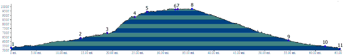
The highest point on this loop combines two approaches of very different character, one an old rail line through tunnels and over bridges - now a fairly wide, sometimes dusty road with a roadbed engineered to carry a train. In past years erosion has sometimes outpaced preservation efforts. But as of 2021 the road is in a very maintained state. The other approach is a steep jeep road - and the name Shelf Road says it all. The two linked picture pages are divided in the two approaches.
Approaches From South West via Shelf Road. Both
Fields Ave on the east side of Canyon City, and
Red Canyon Ave further west, cross US50, and
directly reach the paved road leading to Shelf
Road. The road winds through a wide arid valley,
sometimes in diagonals, sometimes in a square
pattern and sometimes in curves, as if to follow
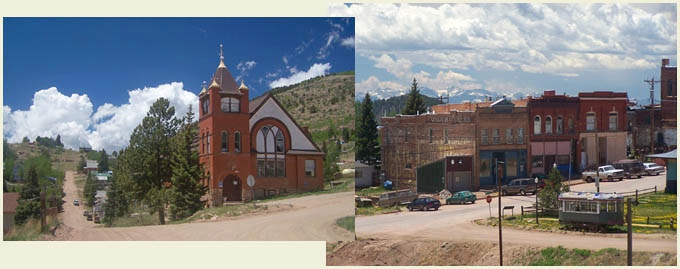
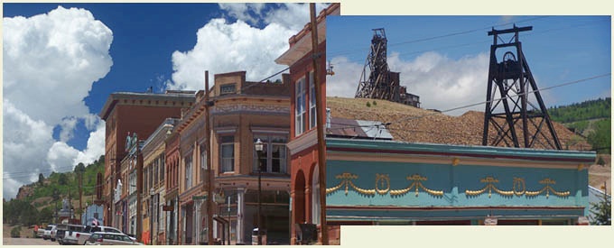
old land boundaries. Both mining towns along this route share a common
history, but now they appear very differently in
the present. Cripple Creek is popular with
visitors, who come here to gamble away their money
in a mixture of new buildings and old buildings
permitted to survive. I was very annoyed by this
in the past. But in post Corona 2021, the town
seemed very civil and pleasantly subdued. On the
other hand, Cripple Creek missed out on the
gambing money. It is a mixture of a functioning
mining town with a pleasant air of historic decay.
Much renovation seems to have taken place in
recent years. Cripple Creek may be popular with
visitors, but Victor is the real attraction for
me. It is hard to really designate a summit point.
The section between the west side of Victor and
the indicated summit of Phantom Canyon really
consists of small rolling hills, and that was the
highest point on my profile. But the higher town
streets in Victor are probably at a higher
elevation.
From South East via Phantom Canyon. (also
described upwards) Phantom Canyon is the extension
of Co67, heading north from Florence. Its name is
signed where it crosses US50. When completing a
loop with the other approach CR123 offers a
shorter, more pleasant paved connection with
Canyon City, After crossing Mc Kenzie Road, Phantom Canyon
swerves east, to follow the creek that has sliced
through the first hogback. This is not the
beginning of the canyon quite yet. But it's
getting closer. The road soon turns to dirt at the
beginning of the BLM land boundary, The road
follows a shallow, uniformly sloping canyon. Where
the slope wasn't quite as uniform, railroad cuts
and two short tunnels help in making it so. This
canyon is not as deep and impressive as Shelf
Road, but countless spires and hoodoos eroded into
the sandstone give it an enchanted fairy-tale
appearance, That must have been a incredible train
trip. Signs point out old railroad landmarks. After the route diverts through a wide side
canyon, it climbs to half height of the main
canyon and then traverses along its upper slope.
The massive railroad cut now becomes the center of
attention and this is the most scenic section of
the road. After the route crosses a newly
reconstructed bridge, it switches back to a
southerly direction, and for the first time
presents a view overlooking a part of the route
traveled so far. Soon afterwards the Sangre de
Cristo Range appears at the south western horizon.
But there is still a nicer view of them to come
right before the crest, and before the descent.
You need a good altimeter or topographic to figure
out where the summit really is: by a tiny margin,
a small distance to the east side of Victor. cLiCk on image ,
arrows , or thumbnails to advance
slideshow Dayrides with this summit as highest point ( < Hoosier
Pass | > ) Notes: includes ~300ft and 2 miles to approach loop from campsite ( | Skyline Drive s(u) > ) same summit point , additional out and back: lower Phantom Canyon > up Phantom Canyon Rd > Phanton Canyon - Shelf Rd(sh) > several slow sight seeing loops around Victor > Co67 west > Cripple Creek <> out and back on CR1 Florrisant Rd to high point west of Cripple Creek << down Shelf Rd > detour in Cripple Creek > CR123 west > up Phantom Canyon Rd back to starting point: 71.8miles with 5890ft of climbing in 8:15hours (garmin etrex30 m5:21.5.5) Notes: same loop as above in reverse order with more slow and rolling sightseeing detours in the mining towns. I think going up Phantom Canyon and down Shelf Rd requires more energy than reverse order. Much energy is dissipated in the brakepads on the upper slopes of Shelf Rd, while the decent down Phantom Canyon is very efficient energy wise. On the other hand, going up the upper slopes of Shelf Rd (first trip above) required quite a bit of walking for me. A Dayride with this point as shoulder point is on page: Hoosier Pass (Pike's Peak) 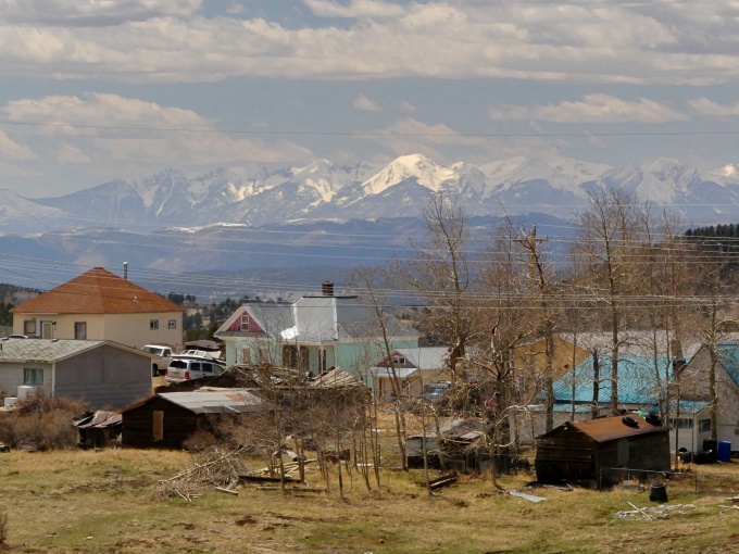
|
|
|
advertisement |
|
|
advertisement |